📖 Introduction
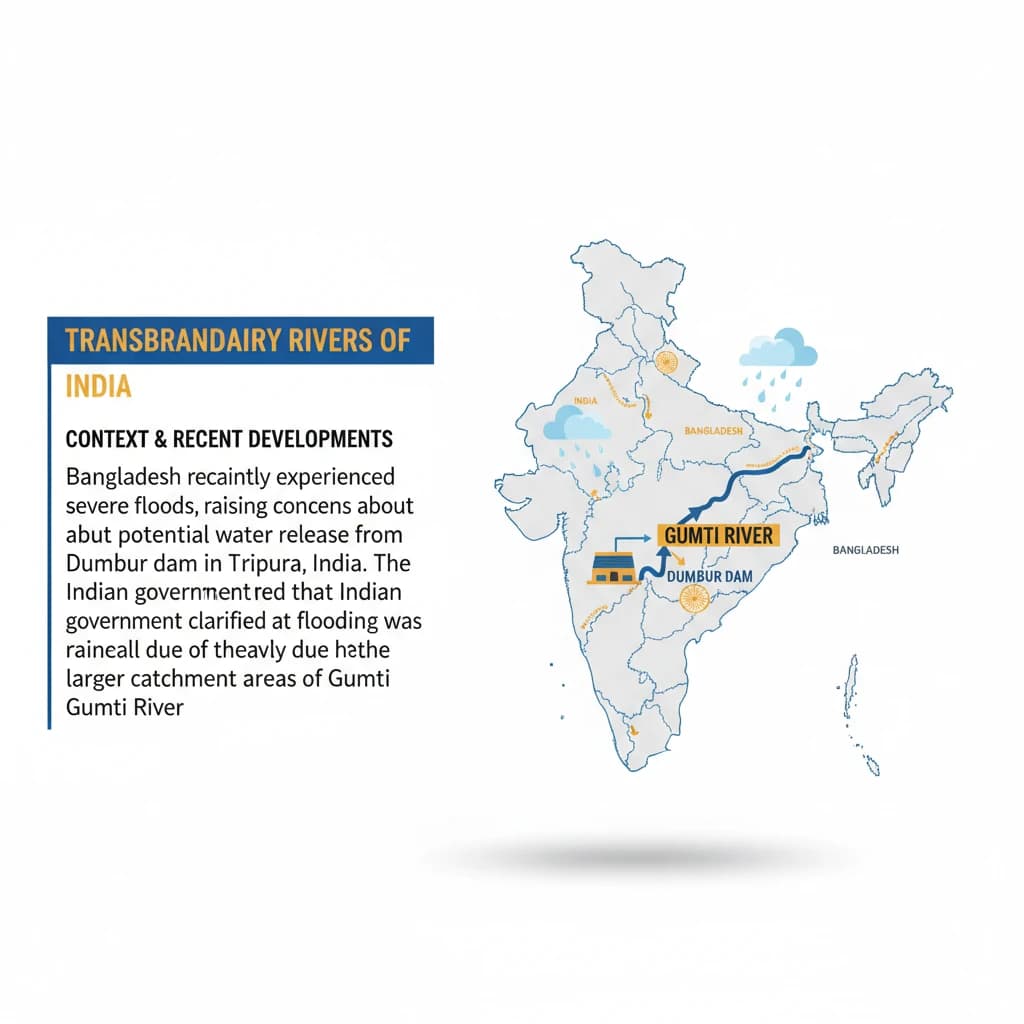
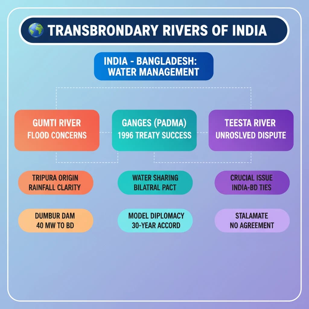
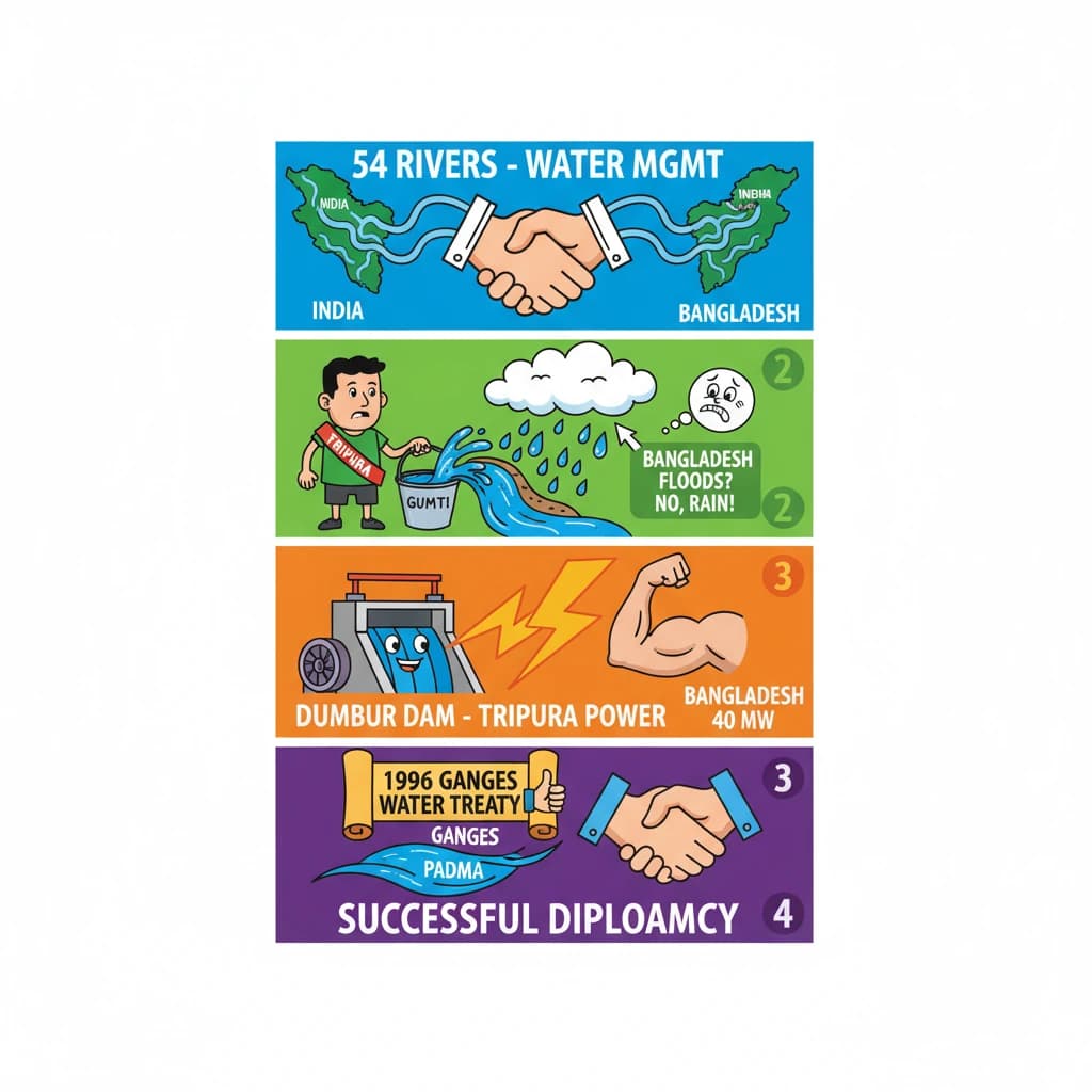
<h4>Context and Recent Developments</h4><p><strong>Bangladesh</strong> recently experienced severe floods, raising concerns about potential water release from the <strong>Dumbur dam</strong> in <strong>Tripura, India</strong>. This incident highlighted the complexities of managing shared water resources.</p><p>The <strong>Indian government</strong> clarified that the flooding was primarily due to heavy rainfall in the larger catchment areas of the <strong>Gumti River</strong>. This river flows through both nations, and the dam's water release was not the cause of the extensive inundation.</p><h4>The Gumti River System</h4><p>The <strong>Gumti River</strong>, also known as <strong>Gomti</strong> or <strong>Gumati</strong>, originates in <strong>Tripura, India</strong>. It subsequently flows into the district of <strong>Comilla</strong> in <strong>Bangladesh</strong>, making it a significant transboundary waterway.</p><div class='info-box'><p><strong>Right Bank Tributaries of Gumti River:</strong></p><ul><li><strong>Korchi Gang</strong></li><li><strong>Pitra Gang</strong></li><li><strong>San Gang</strong></li><li><strong>Mailak Chhara</strong></li><li><strong>Surma Chhara</strong></li></ul><p><strong>Left Bank Tributaries of Gumti River:</strong></p><ul><li><strong>Ek Chhari</strong></li><li><strong>Maharani Chhara</strong></li><li><strong>Ganga</strong></li></ul></div><h4>Dumbur Dam and Power Generation</h4><p>The <strong>Dumbur Dam</strong> is constructed on the <strong>Gumti River</strong> within <strong>Tripura</strong>. It plays a crucial role in regional power generation.</p><div class='info-box'><ul><li><strong>Height:</strong> 30 metres</li><li><strong>Purpose:</strong> Generates power that feeds into a grid.</li><li><strong>Beneficiary:</strong> <strong>Bangladesh</strong> draws <strong>40 Megawatts (MW)</strong> of power from <strong>Tripura</strong>.</li></ul></div><h4>Dumboor Lake: Source and Significance</h4><p><strong>Dumboor Lake</strong> is located in <strong>Gandacherra</strong>, near <strong>Agartala</strong>. It is now part of the <strong>Jatanbari/Hydel Project</strong> and is recognized as the source of the <strong>Gumti River</strong>.</p><div class='info-box'><p>The lake is formed by the confluence of the <strong>Raima</strong> and <strong>Sarma rivers</strong>. It is particularly noted for its diverse species of fish.</p><p>An annual cultural event, the <strong>“Poush Sankranti Mela”</strong>, is hosted at the lake every year on <strong>January 14th</strong>.</p></div><h4>Transboundary Rivers Shared by India and Bangladesh</h4><p><strong>India</strong> and <strong>Bangladesh</strong> share a total of <strong>54 rivers</strong>. India has the largest number of rivers flowing into the <strong>Bay of Bengal</strong> via <strong>Bangladesh</strong>, highlighting the extensive hydrological connectivity between the two nations.</p><h4>The Ganges River System (Padma in Bangladesh)</h4><p>The <strong>Ganges</strong> is a major transboundary river, flowing from <strong>India</strong> into <strong>Bangladesh</strong>. It traverses the vast <strong>Gangetic plain</strong> of <strong>North India</strong> before entering Bangladesh, where it is known as the <strong>Padma</strong>.</p><div class='info-box'><p><strong>Major Left Bank Tributaries (India):</strong></p><ul><li><strong>Gomti</strong></li><li><strong>Ghaghara</strong></li><li><strong>Gandak</strong></li><li><strong>Kosi</strong></li></ul><p><strong>Major Right Bank Tributaries (India):</strong></p><ul><li><strong>Yamuna</strong></li><li><strong>Son</strong></li><li><strong>Punpun</strong></li><li><strong>Damodar</strong></li></ul></div><p>In <strong>Bangladesh</strong>, the <strong>Ganges (Padma)</strong> has only one primary tributary, the <strong>Mahananda</strong>. However, it gives rise to several significant distributaries.</p><div class='info-box'><p><strong>Ganges Distributaries (Bangladesh):</strong></p><ul><li><strong>Khamati</strong></li><li><strong>Nabaganga</strong></li><li><strong>Bhairab</strong></li><li><strong>Kumar</strong></li><li><strong>Gorai-Madhumati</strong></li><li><strong>Arial Khan</strong></li></ul></div><h4>The Ghaghara River</h4><p>The <strong>Ghaghara River</strong> originates in the <strong>Tibetan Plateau</strong>. It is known for its high discharge, especially during the monsoon season, and eventually joins the <strong>Ganges</strong> near <strong>Patna</strong>.</p><h4>The Son River</h4><p>The <strong>Son River</strong> flows through the <strong>Kaimur Range</strong>. It covers a distance of <strong>487 miles</strong> before merging with the <strong>Ganges</strong> upstream of <strong>Patna, Bihar</strong>.</p><h4>The Teesta River and Water Sharing Dispute</h4><p>The <strong>Teesta River</strong> originates in the <strong>Himalayas</strong> and flows through <strong>Sikkim</strong> and <strong>West Bengal</strong> in <strong>India</strong>. It then merges with the <strong>Brahmaputra</strong> (known as <strong>Jamuna</strong> in <strong>Bangladesh</strong>) after entering <strong>Bangladesh</strong>.</p><p><strong>Bangladesh</strong> has consistently advocated for a fair allocation of <strong>Teesta River waters</strong> from <strong>India</strong>. This request aims for an arrangement similar to the successful <strong>Ganga Water Treaty of 1996</strong>, but a resolution is still pending.</p><h4>The 1996 Ganges Water Treaty</h4><p>The <strong>1996 Ganges Water Treaty</strong> between <strong>India</strong> and <strong>Bangladesh</strong> was a landmark agreement. Its primary objective was to resolve disputes over water flow entitlements, particularly concerning the <strong>Ganges River</strong>.</p><div class='key-point-box'><p>The disputes emerged after the construction of the <strong>Farakka Barrage</strong> in <strong>1975</strong>. This barrage was built to divert <strong>Ganges water</strong> to the <strong>Hooghly River</strong> to maintain the navigability and ecological health of <strong>Calcutta port</strong>.</p></div><div class='exam-tip-box'><p>Understanding the dynamics of <strong>transboundary rivers</strong> like the <strong>Ganges</strong> and <strong>Teesta</strong>, along with their associated treaties and disputes, is crucial for <strong>UPSC Mains GS Paper 2 (International Relations)</strong> and <strong>GS Paper 1 (Geography)</strong>. Focus on geographical facts, bilateral relations, and environmental impacts.</p></div>