Tsangyang Gyatso Peak - UPSC Geography
What is Tsangyang Gyatso Peak in UPSC Geography?
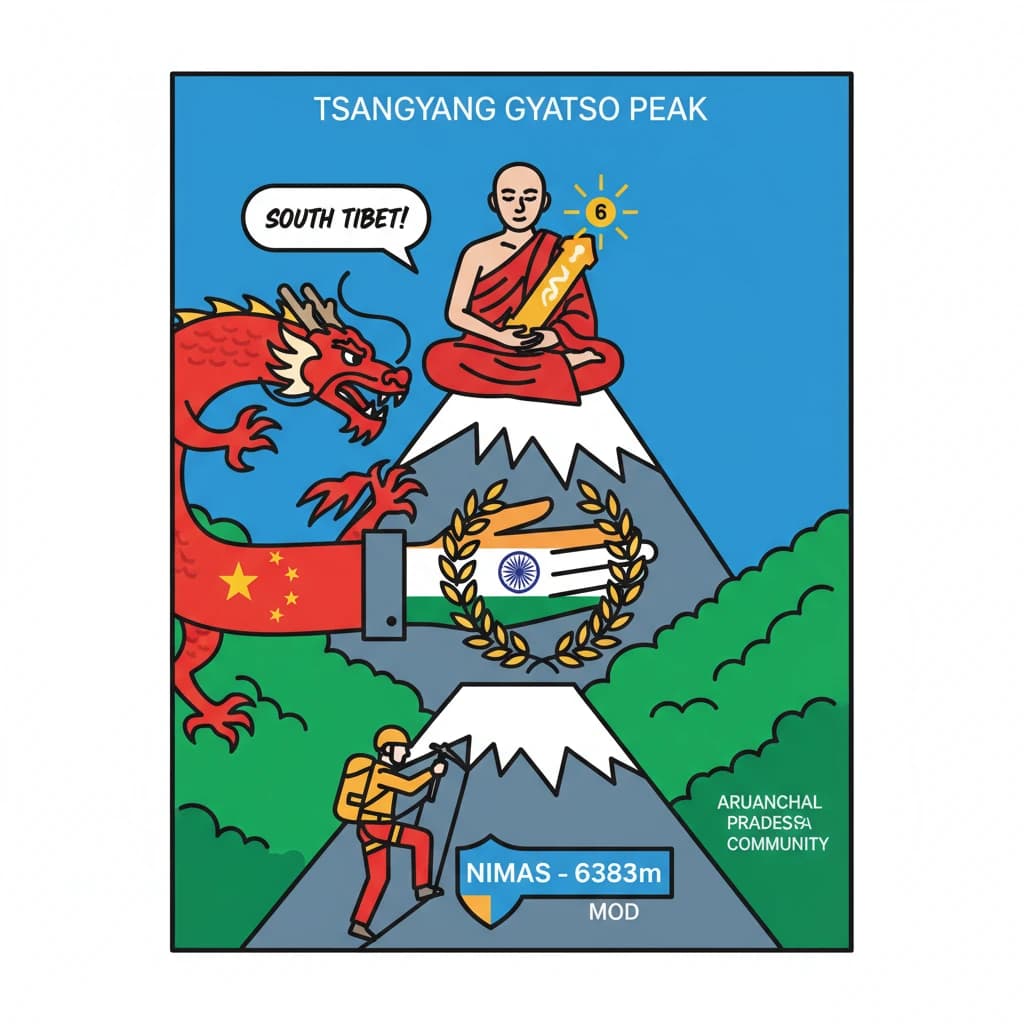
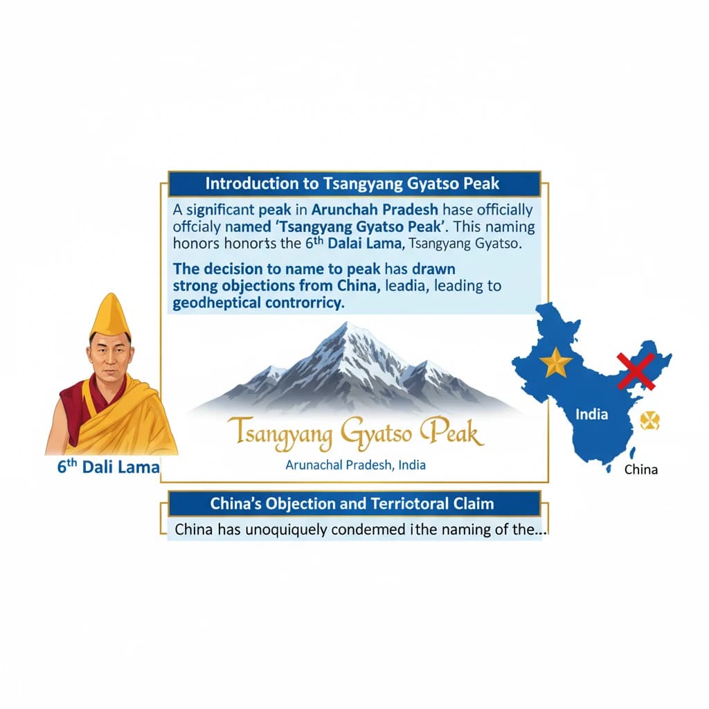
Tsangyang Gyatso Peak is a key topic under Geography for UPSC Civil Services Examination. Key points include: Tsangyang Gyatso Peak in Arunachal Pradesh is named after the 6th Dalai Lama, Tsangyang Gyatso.. China objects to the naming, claiming Arunachal Pradesh as 'South Tibet' (Zangnan).. India views the naming as a tribute to Tsangyang Gyatso's wisdom and his contributions to the Monpa community.. Understanding this topic is essential for both UPSC Prelims and Mains preparation.
Why is Tsangyang Gyatso Peak important for UPSC exam?
Tsangyang Gyatso Peak is a Medium-level topic in UPSC Geography. It is tested in both Prelims (factual MCQs) and Mains (analytical answer writing). Previous year UPSC questions have frequently covered aspects of Tsangyang Gyatso Peak, making it essential for comprehensive IAS preparation.
How to prepare Tsangyang Gyatso Peak for UPSC?
To prepare Tsangyang Gyatso Peak for UPSC: (1) Study the comprehensive notes covering all key concepts on Vaidra. (2) Practice previous year questions on this topic. (3) Connect it with current affairs using daily updates. (4) Revise using key takeaways and mind maps available for Geography. (5) Write practice answers linking Tsangyang Gyatso Peak to related GS Paper topics.
Key takeaways of Tsangyang Gyatso Peak for UPSC
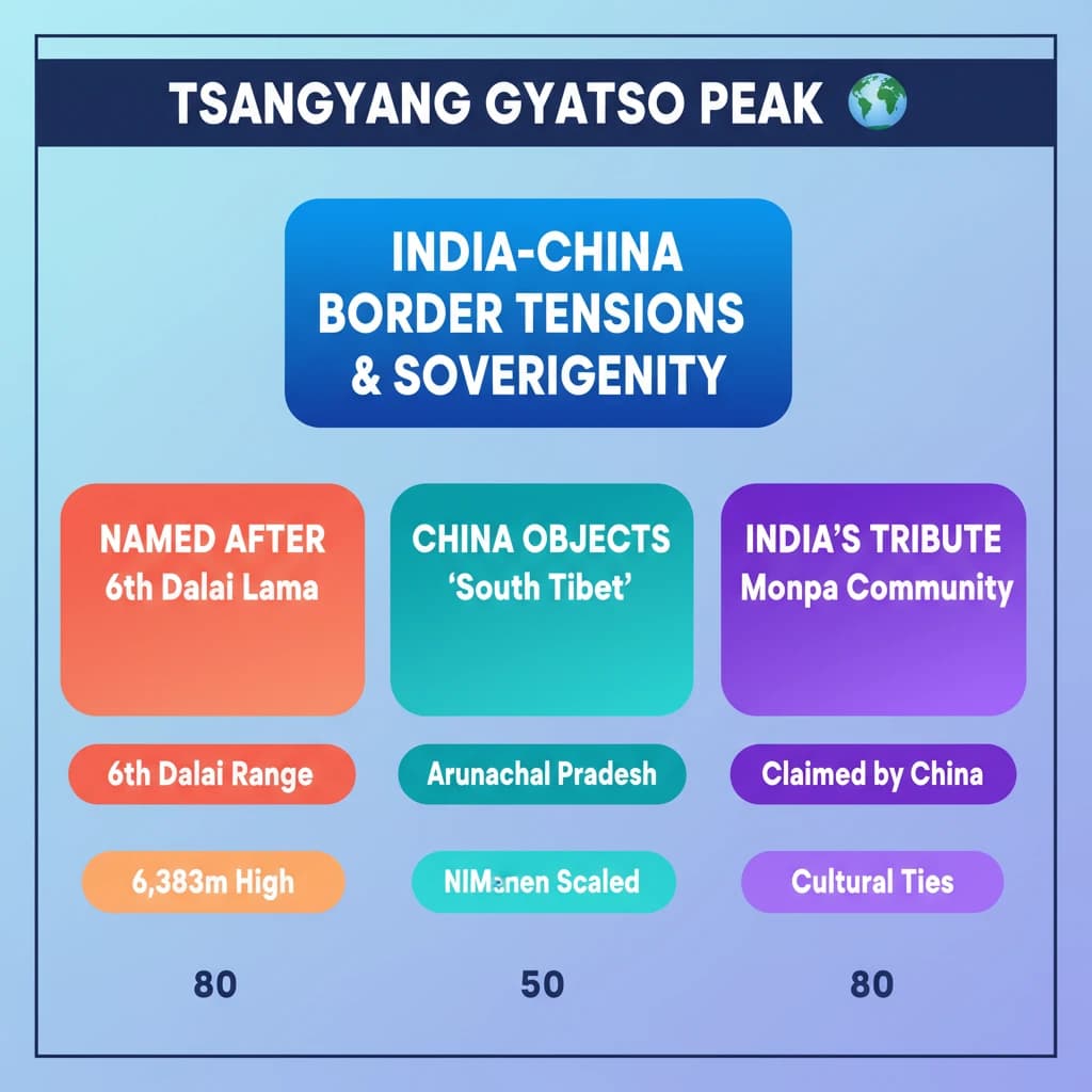
- Tsangyang Gyatso Peak in Arunachal Pradesh is named after the 6th Dalai Lama, Tsangyang Gyatso.
- China objects to the naming, claiming Arunachal Pradesh as 'South Tibet' (Zangnan).
- India views the naming as a tribute to Tsangyang Gyatso's wisdom and his contributions to the Monpa community.
- The peak is 6,383m high, located in the Gorichen range, and was scaled by NIMAS (under Ministry of Defence).
- The incident underscores the ongoing India-China border tensions and India's assertion of sovereignty and cultural ties in the region.
Tsangyang Gyatso Peak
📖 Introduction
💡 Key Takeaways
- •Tsangyang Gyatso Peak in Arunachal Pradesh is named after the 6th Dalai Lama, Tsangyang Gyatso.
- •China objects to the naming, claiming Arunachal Pradesh as 'South Tibet' (Zangnan).
- •India views the naming as a tribute to Tsangyang Gyatso's wisdom and his contributions to the Monpa community.
- •The peak is 6,383m high, located in the Gorichen range, and was scaled by NIMAS (under Ministry of Defence).
- •The incident underscores the ongoing India-China border tensions and India's assertion of sovereignty and cultural ties in the region.
🧠 Memory Techniques