Loading page, please wait…
Climate Change and African Easterly Waves - UPSC Geography
What is Climate Change and African Easterly Waves in UPSC Geography?
Climate Change and African Easterly Waves is a key topic under Geography for UPSC Civil Services Examination. Key points include: African Easterly Waves (AEWs) are summer weather systems over northern Africa, moving east to west towards the Atlantic.. A recent study predicts climate change will increase AEW intensity and frequency, leading to more extreme flooding in the Sahel region.. AEWs are significant precursors to the formation of many Atlantic tropical cyclones.. Understanding this topic is essential for both UPSC Prelims and Mains preparation.
Why is Climate Change and African Easterly Waves important for UPSC exam?
Climate Change and African Easterly Waves is a Medium-level topic in UPSC Geography. It is tested in both Prelims (factual MCQs) and Mains (analytical answer writing). Previous year UPSC questions have frequently covered aspects of Climate Change and African Easterly Waves, making it essential for comprehensive IAS preparation.
How to prepare Climate Change and African Easterly Waves for UPSC?
To prepare Climate Change and African Easterly Waves for UPSC: (1) Study the comprehensive notes covering all key concepts on Vaidra. (2) Practice previous year questions on this topic. (3) Connect it with current affairs using daily updates. (4) Revise using key takeaways and mind maps available for Geography. (5) Write practice answers linking Climate Change and African Easterly Waves to related GS Paper topics.
Key takeaways of Climate Change and African Easterly Waves for UPSC
- African Easterly Waves (AEWs) are summer weather systems over northern Africa, moving east to west towards the Atlantic.
- A recent study predicts climate change will increase AEW intensity and frequency, leading to more extreme flooding in the Sahel region.
- AEWs are significant precursors to the formation of many Atlantic tropical cyclones.
- The Red Sea borders six countries (Yemen, Saudi Arabia, Egypt, Sudan, Eritrea, Djibouti), and the Gulf of Aqaba borders four (Egypt, Israel, Jordan, Saudi Arabia).
- Understanding AEWs is crucial for predicting West African weather and Atlantic hurricane seasons.
Climate Change and African Easterly Waves
Medium⏱️ 8 min read
geography
📖 Introduction
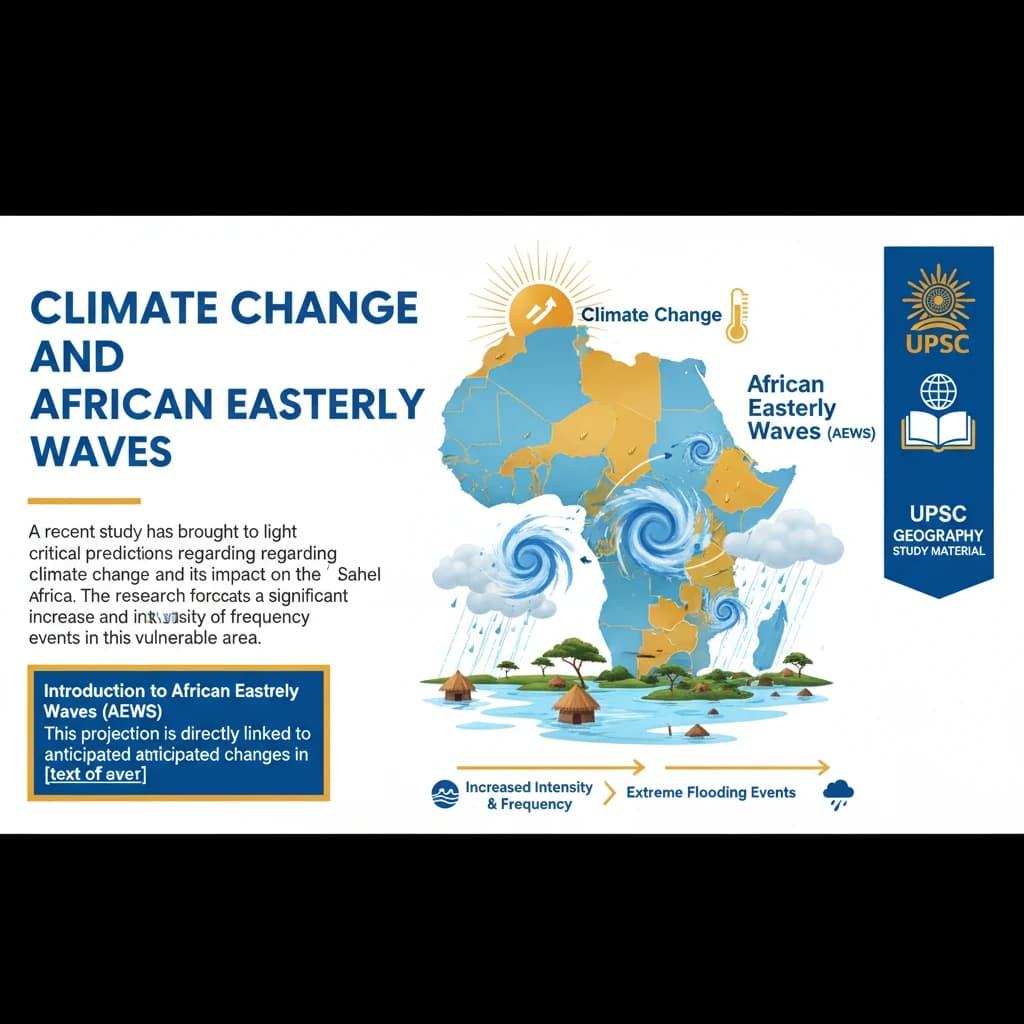
Introduction to African Easterly Waves (AEWs)
A recent study has brought to light critical predictions regarding climate change and its impact on the Sahel region of Africa.
The research forecasts a significant increase in the intensity and frequency of extreme flooding events in this vulnerable area.
This projection is directly linked to anticipated changes in African Easterly Waves (AEWs), as detailed in a study published in Communications Earth & Environment.
Definition and Characteristics of AEWs
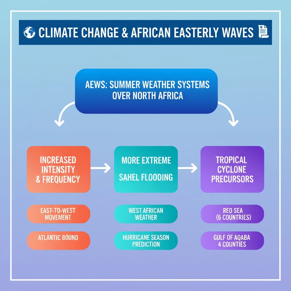
African Easterly Waves (AEWs) are distinct weather systems that play a crucial role in atmospheric dynamics over northern Africa.
These waves typically form during the summer months and exhibit a characteristic movement pattern, propagating from east to west towards the Atlantic Ocean.
AEWs are known to be significant precursors to the formation of tropical cyclones in the Atlantic basin, influencing weather patterns across West Africa.
Projected Climate Change Impacts
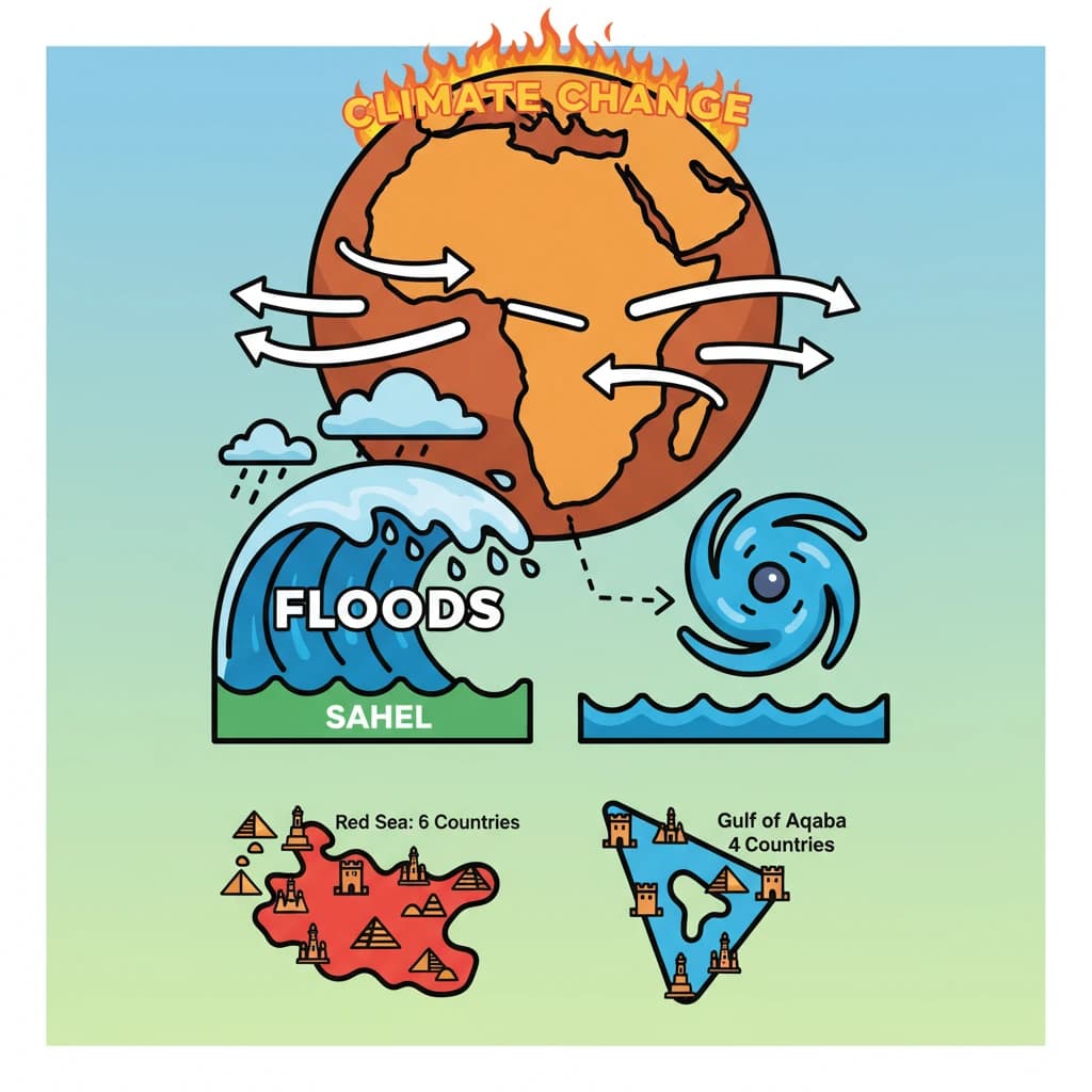
The study specifically predicts that alterations driven by climate change will intensify these waves.
This intensification will, in turn, lead to a higher occurrence and severity of extreme flooding in the Sahel region.
Understanding the dynamics of AEWs and their climate change linkages is crucial for UPSC Mains GS Paper 1 (Physical Geography) and GS Paper 3 (Disaster Management, Environment).
Geographical Context: Red Sea and Surrounding Regions
The Red Sea is a vital waterway, strategically bordering six countries, which are divided between its eastern and western shores.
- To the east, it borders Yemen and Saudi Arabia.
- To the west, it borders Egypt, Sudan, Eritrea, and Djibouti.
The Gulf of Aqaba, an important northern inlet of the Red Sea, is bordered by four nations: Egypt, Israel, Jordan, and Saudi Arabia.
Prominent Islands in the Red Sea region include Tiran (near the Gulf of Aqaba), Shadwan (at the Gulf of Suez), and Yemen-controlled islands such as Kamaran, Perim, Hanish, and Socotra.
The largest groups of islands are the Farasan Islands located in the east and the Dahlak Archipelago situated in the west.
💡 Key Takeaways
- •African Easterly Waves (AEWs) are summer weather systems over northern Africa, moving east to west towards the Atlantic.
- •A recent study predicts climate change will increase AEW intensity and frequency, leading to more extreme flooding in the Sahel region.
- •AEWs are significant precursors to the formation of many Atlantic tropical cyclones.
- •The Red Sea borders six countries (Yemen, Saudi Arabia, Egypt, Sudan, Eritrea, Djibouti), and the Gulf of Aqaba borders four (Egypt, Israel, Jordan, Saudi Arabia).
- •Understanding AEWs is crucial for predicting West African weather and Atlantic hurricane seasons.
🧠 Memory Techniques
95% Verified Content
📚 Reference Sources
•Communications Earth & Environment (cited study)