Loading page, please wait…
Golan Heights: Geography, History, and Strategic Importance - UPSC Geography
What is Golan Heights: Geography, History, and Strategic Importance in UPSC Geography?
Golan Heights: Geography, History, and Strategic Importance is a key topic under Geography for UPSC Civil Services Examination. Key points include: The Golan Heights is a 1,200 sq km rocky plateau, strategically located between Syria and Israel, overlooking the Jordan River Valley.. Israel captured most of the Golan Heights from Syria in the 1967 Six-Day War and annexed it in 1981, a move largely unrecognized internationally.. The area is a vital security buffer for Israel and a key source of water for the arid region.. Understanding this topic is essential for both UPSC Prelims and Mains preparation.
Why is Golan Heights: Geography, History, and Strategic Importance important for UPSC exam?
Golan Heights: Geography, History, and Strategic Importance is a Medium-level topic in UPSC Geography. It is tested in both Prelims (factual MCQs) and Mains (analytical answer writing). Previous year UPSC questions have frequently covered aspects of Golan Heights: Geography, History, and Strategic Importance, making it essential for comprehensive IAS preparation.
How to prepare Golan Heights: Geography, History, and Strategic Importance for UPSC?
To prepare Golan Heights: Geography, History, and Strategic Importance for UPSC: (1) Study the comprehensive notes covering all key concepts on Vaidra. (2) Practice previous year questions on this topic. (3) Connect it with current affairs using daily updates. (4) Revise using key takeaways and mind maps available for Geography. (5) Write practice answers linking Golan Heights: Geography, History, and Strategic Importance to related GS Paper topics.
Key takeaways of Golan Heights: Geography, History, and Strategic Importance for UPSC
- The Golan Heights is a 1,200 sq km rocky plateau, strategically located between Syria and Israel, overlooking the Jordan River Valley.
- Israel captured most of the Golan Heights from Syria in the 1967 Six-Day War and annexed it in 1981, a move largely unrecognized internationally.
- The area is a vital security buffer for Israel and a key source of water for the arid region.
- The 1974 Agreement on Disengagement established a ceasefire line monitored by the UN Disengagement Observer Force (UNDOF).
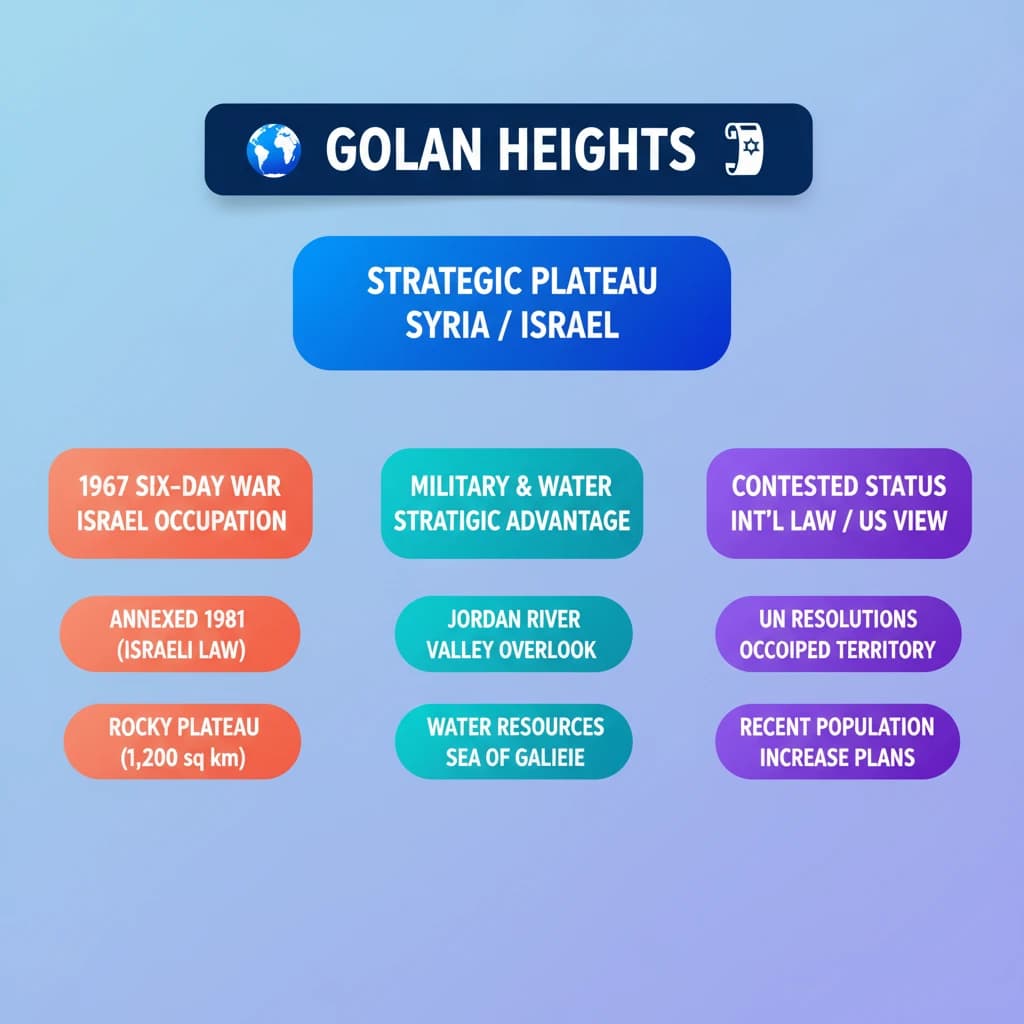
- Recent Israeli plans to double its population in the Golan Heights have drawn international condemnation, including a UNGA resolution supported by India, demanding Israel's withdrawal.
Golan Heights: Geography, History, and Strategic Importance
Medium⏱️ 7 min read
geography
📖 Introduction
Why the Golan Heights is in News?
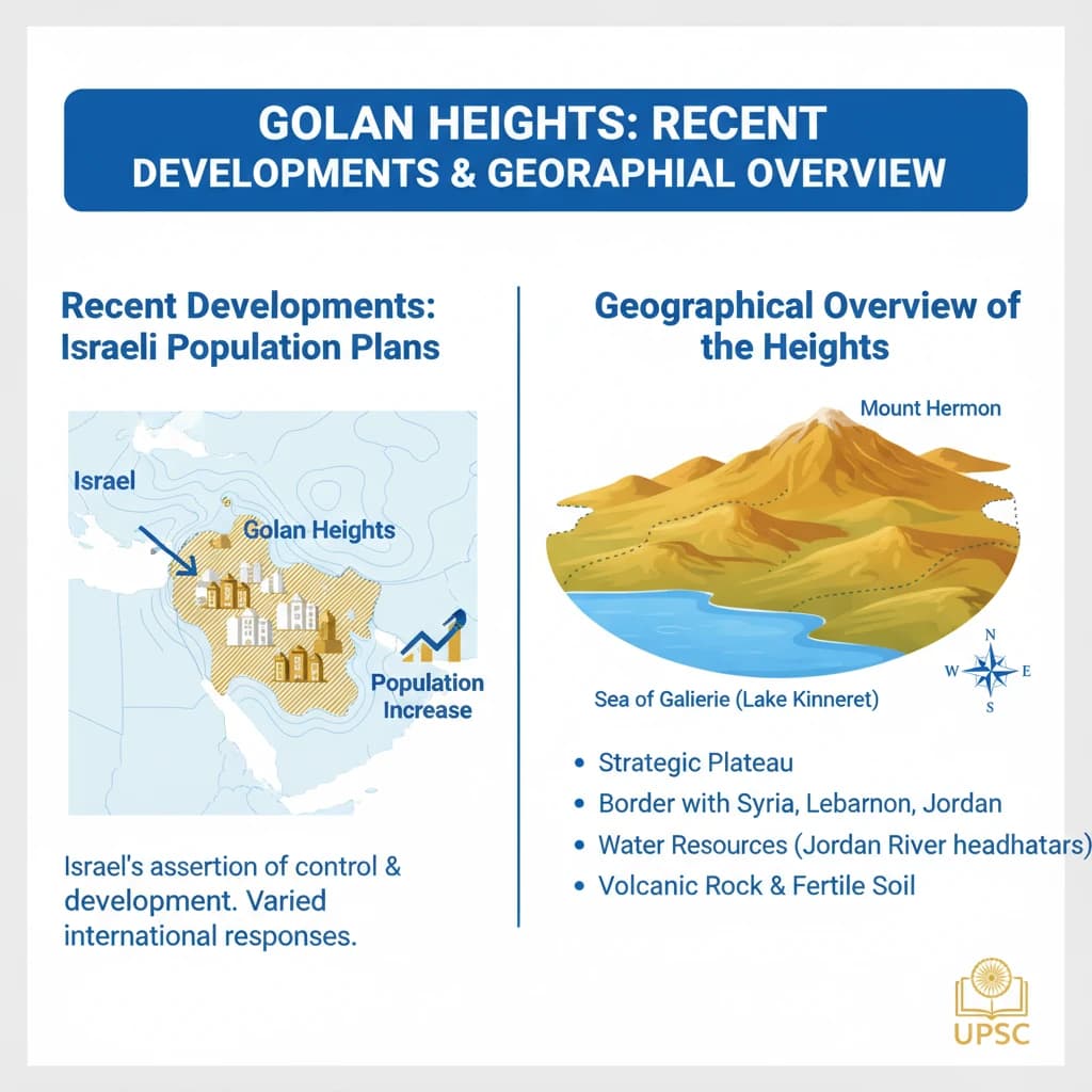
The Golan Heights has recently gained significant international attention. This is due to Israel's announced plans to substantially increase its population in this strategically vital region.
UPSC Insight: Recent developments often form the basis of current affairs questions in Prelims and can be crucial for understanding geopolitical dynamics in Mains Paper 2 (International Relations).
Geography of the Golan Heights
The Golan Heights is a distinctive 1,200-square-kilometre rocky plateau located in southwestern Syria. Its elevated position offers a commanding view over the Jordan River Valley.
The name Golan is historically linked to the biblical city of refuge, Golan in Bashan, as mentioned in ancient texts.
Geographical Boundaries:
- North: Mount Hermon
- South: Yarmūk River
- West: Jordan River and Sea of Galilee
- East: Seasonal Wadi al-Ruqqād
This area is a critical source of water for a naturally arid region. Rainwater collected from the Golan's catchment area flows directly into the Jordan River, highlighting its ecological and economic importance.
Historical Context and Conflicts
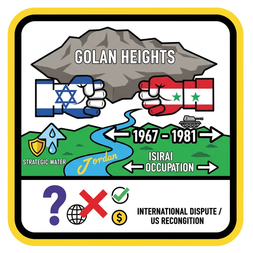
Israel initially captured the majority of the Golan Heights from Syria during the 1967 Six-Day War. This marked a significant shift in regional control.
In 1973, Syria attempted to reclaim the territory during the Yom Kippur War, but this effort ultimately failed to dislodge Israeli forces.
Following the Yom Kippur War, the Agreement on Disengagement was signed between Israel and Syria in 1974. This agreement established a ceasefire line.
Key Historical Events:
- 1967: Israel seizes Golan Heights (Six-Day War)
- 1973: Syria's failed attempt to recapture Golan (Yom Kippur War)
- 1974: Agreement on Disengagement signed
- 1981: Israel annexes Golan Heights
- 2019: US acknowledges Israeli sovereignty over Golan
The 1974 Agreement also led to the establishment of the United Nations Disengagement Observer Force (UNDOF). Its mandate is to monitor the ceasefire line in the Golan Heights.
Israel formally annexed the region in 1981. However, this annexation has not been recognized by the international community. The United States, in 2019, acknowledged Israeli sovereignty over the area, a move that was largely isolated.
Syria continues to demand the return of the Golan Heights, viewing it as occupied territory under international law.
Military Presence and Strategic Significance
The Golan Heights remains divided by a United Nations-monitored demilitarized zone (DMZ). Israeli and Syrian forces are separated by an “Area of Separation,” which is a buffer zone established under the 1974 Agreement.
Militarily, the Golan Heights is considered a vital security buffer zone for Israel. Its presence here acts as a significant deterrent against potential threats emanating from Syria and other regional actors.
The plateau's high elevation provides Israel with a crucial advantage. It allows for effective monitoring of military movements and other activities in both Syria and Lebanon, enhancing its regional security posture.
India's Stance on Golan Heights
In December 2024, India voted in favor of a United Nations General Assembly (UNGA) resolution. This resolution explicitly demanded Israel's withdrawal from the occupied Syrian Golan Heights.
The resolution further emphasized the illegality of Israeli settlement construction and other activities in the occupied Syrian Golan since 1967. This highlights India's consistent position on adherence to international law regarding occupied territories, relevant for Mains Paper 2 (International Relations).
💡 Key Takeaways
- •The Golan Heights is a 1,200 sq km rocky plateau, strategically located between Syria and Israel, overlooking the Jordan River Valley.
- •Israel captured most of the Golan Heights from Syria in the 1967 Six-Day War and annexed it in 1981, a move largely unrecognized internationally.
- •The area is a vital security buffer for Israel and a key source of water for the arid region.
- •The 1974 Agreement on Disengagement established a ceasefire line monitored by the UN Disengagement Observer Force (UNDOF).
- •Recent Israeli plans to double its population in the Golan Heights have drawn international condemnation, including a UNGA resolution supported by India, demanding Israel's withdrawal.
🧠 Memory Techniques
95% Verified Content
📚 Reference Sources
•United Nations official documents regarding UNDOF and resolutions on Golan Heights
•Reputable news sources for recent developments (e.g., Reuters, BBC, Al Jazeera)