Loading page, please wait…
Landslide Prone Areas - UPSC Geography
What is Landslide Prone Areas in UPSC Geography?
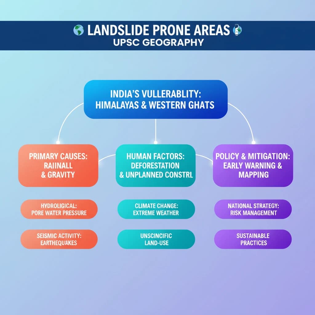
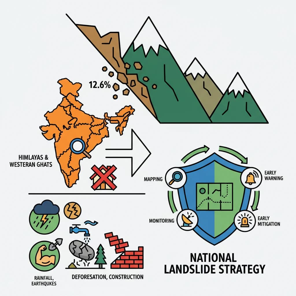
Landslide Prone Areas is a key topic under Geography for UPSC Civil Services Examination. Key points include: Approximately 12.6% of India's land area (0.42 million sq. km) is prone to landslides, with the Himalayas and Western Ghats being most vulnerable.. Primary causes include gravitational forces, heavy rainfall, earthquakes, and hydrological factors like increased pore water pressure.. Anthropogenic activities (deforestation, unscientific construction) and climate change exacerbate landslide risk.. Understanding this topic is essential for both UPSC Prelims and Mains preparation.
Why is Landslide Prone Areas important for UPSC exam?
Landslide Prone Areas is a Medium-level topic in UPSC Geography. It is tested in both Prelims (factual MCQs) and Mains (analytical answer writing). Previous year UPSC questions have frequently covered aspects of Landslide Prone Areas, making it essential for comprehensive IAS preparation.
How to prepare Landslide Prone Areas for UPSC?
To prepare Landslide Prone Areas for UPSC: (1) Study the comprehensive notes covering all key concepts on Vaidra. (2) Practice previous year questions on this topic. (3) Connect it with current affairs using daily updates. (4) Revise using key takeaways and mind maps available for Geography. (5) Write practice answers linking Landslide Prone Areas to related GS Paper topics.
Key takeaways of Landslide Prone Areas for UPSC
- Approximately 12.6% of India's land area (0.42 million sq. km) is prone to landslides, with the Himalayas and Western Ghats being most vulnerable.
- Primary causes include gravitational forces, heavy rainfall, earthquakes, and hydrological factors like increased pore water pressure.
- Anthropogenic activities (deforestation, unscientific construction) and climate change exacerbate landslide risk.
- Government initiatives like the National Landslide Risk Management Strategy focus on mapping, monitoring, early warning, and mitigation.
- Understanding regional geology and implementing sustainable land-use practices are crucial for effective landslide management.

Landslide Prone Areas
Medium⏱️ 10 min read
geography
📖 Introduction
Understanding Landslide Prone Areas in India
Landslides are a significant geological hazard in India, affecting a substantial portion of its landmass. These events involve the movement of a mass of rock, debris, or earth down a slope.
India's diverse topography, coupled with specific geological and climatic conditions, makes it highly susceptible to landslides.
As per the Landslide Atlas of India, approximately 0.42 million sq. km, which accounts for about 12.6% of India's total land area, is identified as prone to landslides.
Regional Distribution of Landslide Vulnerability
The vulnerability to landslides is not uniform across India but is concentrated in specific geographical belts. These regions are characterized by fragile geology, steep slopes, and intense weather patterns.
- North East Himalaya: Covers 0.18 million sq. km, making it the most extensive landslide-prone region.
- North West Himalaya: Accounts for 0.14 million sq. km, another highly vulnerable area.
- Western Ghats and Konkan Hills: Spans 0.09 million sq. km, known for monsoon-triggered landslides.
- Eastern Ghats of Andhra Pradesh: Constitutes 0.01 million sq. km, experiencing localized landslide incidents.
UPSC Insight: Remember the relative proportions and specific regions. Questions often ask about geographical distribution and causative factors. Mapping these regions in your mind can help in answer articulation for GS Paper I Geography.
Primary Causes of Landslides: Gravitational Forces
The fundamental trigger for any landslide is the force of gravity. When the downward pull of gravity on a slope material exceeds the internal strength (shear strength) of that material, a landslide occurs.
Gravitational Forces: This is the overarching principle. When the inherent strength of materials like rocks, sand, silt, and clay is overcome by gravitational pull, the slope fails, leading to downhill movement.
Natural Factors Influencing Landslides
Beyond gravity, several natural factors act as catalysts, reducing the stability of slopes and making them prone to failure.
Impact of Rainfall
Rainfall is a critical natural factor, especially in monsoon-dominated regions. Heavy or prolonged precipitation significantly alters the properties of slope materials.
- Increased Soil Moisture: Water saturates the soil, reducing friction between particles.
- Weakened Cohesion: Water acts as a lubricant, decreasing the binding forces within the soil and rock mass.
- Added Weight: The absorbed water significantly increases the overall weight of the slope material, further enhancing the gravitational pull.
Role of Earthquakes
Earthquakes are potent triggers, particularly in tectonically active zones like the Himalayas. Seismic vibrations can instantaneously destabilize slopes.
Earthquakes destabilize slopes by intense ground shaking, which weakens the integrity of geomaterials. This shaking can lead to liquefaction in saturated soils or cause fractures in rock masses, precipitating landslides.
Influence of Hydrological Factors
Beyond direct rainfall, other hydrological processes contribute to slope instability. The movement and presence of water within the slope material are crucial.
Water seepage through porous materials within a slope increases the pore water pressure. This elevated pressure reduces the effective normal stress within the soil or rock, thereby significantly weakening the overall shear strength of the slope and making it susceptible to failure.
💡 Key Takeaways
- •Approximately 12.6% of India's land area (0.42 million sq. km) is prone to landslides, with the Himalayas and Western Ghats being most vulnerable.
- •Primary causes include gravitational forces, heavy rainfall, earthquakes, and hydrological factors like increased pore water pressure.
- •Anthropogenic activities (deforestation, unscientific construction) and climate change exacerbate landslide risk.
- •Government initiatives like the National Landslide Risk Management Strategy focus on mapping, monitoring, early warning, and mitigation.
- •Understanding regional geology and implementing sustainable land-use practices are crucial for effective landslide management.
🧠 Memory Techniques
95% Verified Content
📚 Reference Sources
•Landslide Atlas of India (Geological Survey of India)
•National Disaster Management Authority (NDMA) reports and guidelines on landslides
•Ministry of Earth Sciences publications on Himalayan geology and hazards