Loading page, please wait…
What are Equatorial Plasma Bubbles (EPBs)? - UPSC Geography
What is What are Equatorial Plasma Bubbles (EPBs)? in UPSC Geography?
What are Equatorial Plasma Bubbles (EPBs)? is a key topic under Geography for UPSC Civil Services Examination. Key points include: EPBs are plasma depletions in the equatorial ionosphere, forming post-sunset, affecting radio waves.. EPBs cause signal degradation for satellite communication and GPS, most frequent during Winter solstice.. Hunga Tonga-Hunga Ha'apai is an undersea volcano; its 2022 eruption was massive, injecting significant water vapour into the stratosphere.. Understanding this topic is essential for both UPSC Prelims and Mains preparation.
Why is What are Equatorial Plasma Bubbles (EPBs)? important for UPSC exam?
What are Equatorial Plasma Bubbles (EPBs)? is a Medium-level topic in UPSC Geography. It is tested in both Prelims (factual MCQs) and Mains (analytical answer writing). Previous year UPSC questions have frequently covered aspects of What are Equatorial Plasma Bubbles (EPBs)?, making it essential for comprehensive IAS preparation.
How to prepare What are Equatorial Plasma Bubbles (EPBs)? for UPSC?
To prepare What are Equatorial Plasma Bubbles (EPBs)? for UPSC: (1) Study the comprehensive notes covering all key concepts on Vaidra. (2) Practice previous year questions on this topic. (3) Connect it with current affairs using daily updates. (4) Revise using key takeaways and mind maps available for Geography. (5) Write practice answers linking What are Equatorial Plasma Bubbles (EPBs)? to related GS Paper topics.
Key takeaways of What are Equatorial Plasma Bubbles (EPBs)? for UPSC
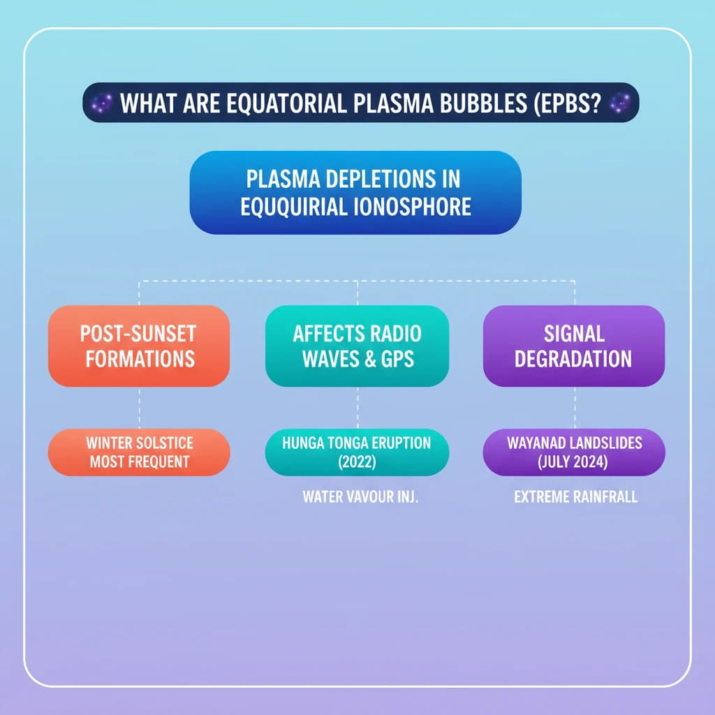
- EPBs are plasma depletions in the equatorial ionosphere, forming post-sunset, affecting radio waves.
- EPBs cause signal degradation for satellite communication and GPS, most frequent during Winter solstice.
- Hunga Tonga-Hunga Ha'apai is an undersea volcano; its 2022 eruption was massive, injecting significant water vapour into the stratosphere.
- Wayanad landslides (July 2024) were triggered by extreme rainfall, fragile terrain, and climate change-induced convective rainfall.
- Landslides are downward movements of rock/soil/debris, intensified by human activity and climate change.
- Effective disaster management and understanding climate impacts are crucial for mitigating natural hazards like landslides and volcanic eruptions.
What are Equatorial Plasma Bubbles (EPBs)?
Medium⏱️ 10 min read
geography
📖 Introduction
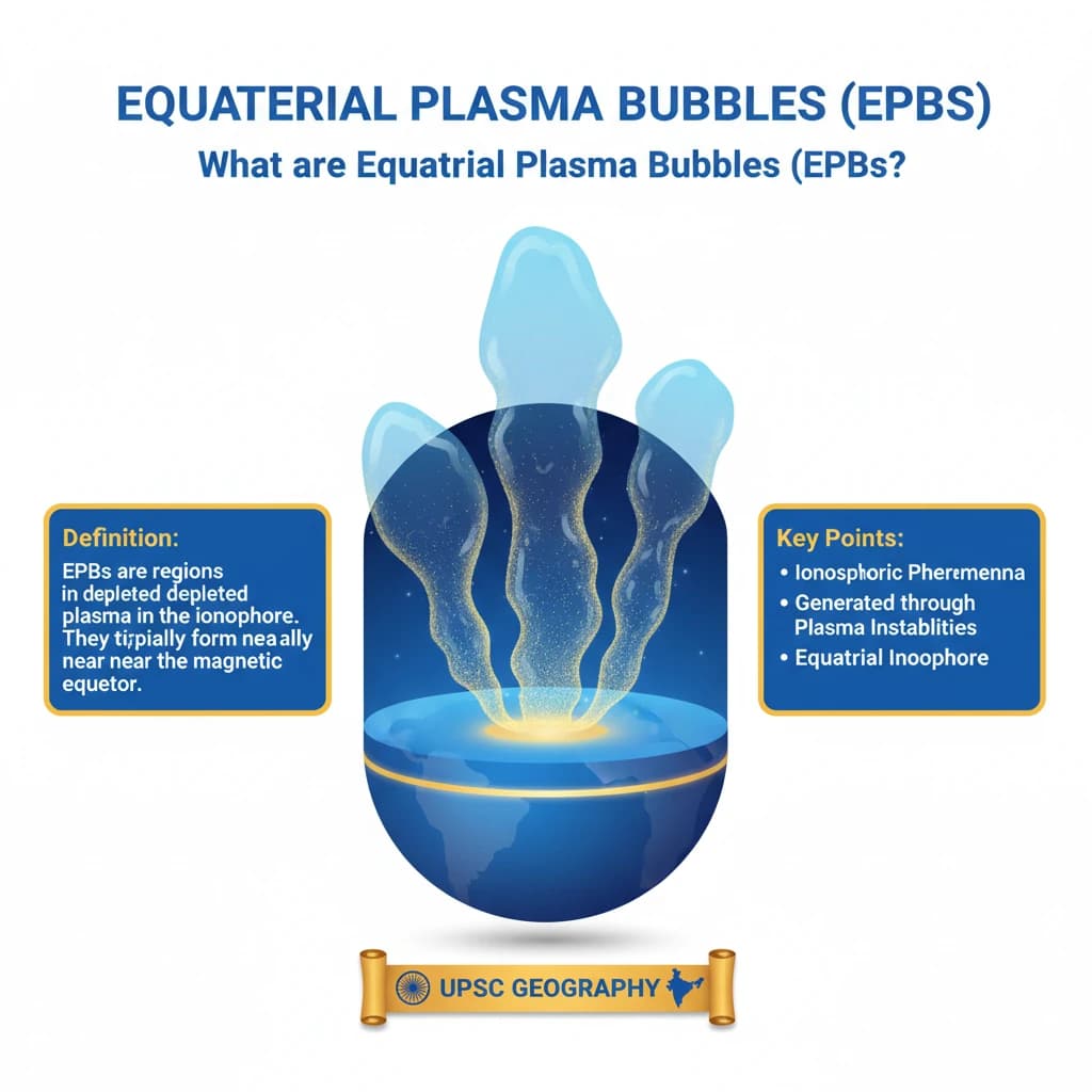
Equatorial Plasma Bubbles (EPBs)
Equatorial Plasma Bubbles (EPBs) are significant ionospheric phenomena. They are generated through plasma instabilities, specifically within the equatorial ionosphere.
Definition: EPBs are regions of depleted plasma in the ionosphere. They typically form near the magnetic equator during post-sunset hours.
These bubbles originate in the equatorial ionosphere but possess the capability to extend, influencing the global ionosphere within a range of 15° North and South of the Earth’s equator.
Impact on Radio Wave Propagation
The presence of EPBs has a notable impact on radio wave propagation. As radio waves traverse the ionosphere, the irregularities linked with EPBs can scatter these waves.
This scattering effect leads directly to signal degradation. It represents a major concern for various communication systems, particularly those that depend on high-frequency radio waves.
Such critical systems include satellite communications and the Global Positioning System (GPS), where signal integrity is paramount.
Seasonal and Regional Variability of EPBs
The occurrence of EPBs exhibits distinct seasonal and regional variability. Their frequency is not constant throughout the year.
Frequency: EPBs are observed to be most frequent during the Winter solstice (around December 21st or 22nd). Conversely, they are least frequent during the Summer solstice (around June 21st).
Hunga Tonga-Hunga Ha'apai Volcano
The Hunga Tonga-Hunga Ha'apai Volcano is an undersea volcanic eruption site. It is associated with two small, uninhabited islands named Hunga-Ha'apai and Hunga-Tonga.
This volcano has a history of erupting regularly over the past few decades. However, the January 2022 eruption was exceptionally massive, considered one of the largest explosions the volcano can produce roughly every thousand years.
One of the primary reasons for its highly explosive nature is the phenomenon known as Fuel-Coolant Interaction, where molten rock rapidly interacts with seawater.
A unique characteristic of the Hunga Tonga eruption was its injection of a massive amount of water vapour directly into the stratosphere. This differs significantly from typical volcanic eruptions.
Usually, volcanic smoke predominantly contains sulphur dioxide. This gas typically leads to a temporary cooling effect on the Earth's surface.
Typical Volcanic Cooling: Sulphur dioxide transforms into sulphate aerosols, which then reflect sunlight back into space. This process causes the surface to cool until the sulphate settles or is washed out by rain.
Wayanad Landslides (July 2024)
A recent study, published in Nature Natural Hazards in July 2024, highlighted the Wayanad landslides. This study underscores the urgent need for enhanced disaster management strategies in vulnerable areas.
In July 2024, the Wayanad district in Kerala experienced a devastating landslide disaster. This event was primarily triggered by a combination of extreme rainfall and the region's inherently fragile ecological conditions.
Causes and Terrain Characteristics
Wayanad's Terrain: The region's terrain is characterized by a soil layer situated over hard rocks. Intense rainfall saturates this soil, significantly weakening its bond with the underlying rocks, thereby precipitating landslides.
The recent warming of the Arabian Sea has contributed to the formation of deep cloud systems. This has resulted in extremely heavy rainfall in the Western Ghats, consequently elevating the risk of landslides.
Furthermore, climate change has caused a shift in the rain-bearing belt. This has led to an increase in convective rainfall in southern regions such as Wayanad.
Convective Rainfall: This type of rainfall occurs when heated air, laden with water vapor, rises, condenses at higher altitudes, and releases rainfall in the same area without being carried away by wind.
What are Landslides?
Definition: A landslide is defined as the downward movement of rock, soil, and debris along a slope. These movements can be triggered by a variety of factors.
Common triggers include heavy rainfall, earthquakes, volcanic activity, human activities, and changes in groundwater levels.
Types of Landslides
- Slides: This type of landslide involves movement along a distinct rupture surface. Slides can be further categorized into:
- Rotational slides: Movement occurs along a curved rupture surface.
- Translational slides: Movement occurs along a relatively planar rupture surface.
💡 Key Takeaways
- •EPBs are plasma depletions in the equatorial ionosphere, forming post-sunset, affecting radio waves.
- •EPBs cause signal degradation for satellite communication and GPS, most frequent during Winter solstice.
- •Hunga Tonga-Hunga Ha'apai is an undersea volcano; its 2022 eruption was massive, injecting significant water vapour into the stratosphere.
- •Wayanad landslides (July 2024) were triggered by extreme rainfall, fragile terrain, and climate change-induced convective rainfall.
- •Landslides are downward movements of rock/soil/debris, intensified by human activity and climate change.
- •Effective disaster management and understanding climate impacts are crucial for mitigating natural hazards like landslides and volcanic eruptions.
🧠 Memory Techniques

95% Verified Content