Loading page, please wait…
What are the Key Facts About the Hirakud Dam? - UPSC Geography
What is What are the Key Facts About the Hirakud Dam? in UPSC Geography?
What are the Key Facts About the Hirakud Dam? is a key topic under Geography for UPSC Civil Services Examination. Key points include: Hirakud Dam is India's first major multipurpose river valley project post-independence, conceived by Er. M. Visvesvaraya in 1937.. It is the longest major earthen dam globally (25.8 km) across the Mahanadi River in Odisha.. Inaugurated by PM Jawaharlal Nehru in 1957, it has an installed capacity of 359.8 MW for hydroelectric power.. Understanding this topic is essential for both UPSC Prelims and Mains preparation.
Why is What are the Key Facts About the Hirakud Dam? important for UPSC exam?
What are the Key Facts About the Hirakud Dam? is a Medium-level topic in UPSC Geography. It is tested in both Prelims (factual MCQs) and Mains (analytical answer writing). Previous year UPSC questions have frequently covered aspects of What are the Key Facts About the Hirakud Dam?, making it essential for comprehensive IAS preparation.
How to prepare What are the Key Facts About the Hirakud Dam? for UPSC?
To prepare What are the Key Facts About the Hirakud Dam? for UPSC: (1) Study the comprehensive notes covering all key concepts on Vaidra. (2) Practice previous year questions on this topic. (3) Connect it with current affairs using daily updates. (4) Revise using key takeaways and mind maps available for Geography. (5) Write practice answers linking What are the Key Facts About the Hirakud Dam? to related GS Paper topics.
Key takeaways of What are the Key Facts About the Hirakud Dam? for UPSC
- Hirakud Dam is India's first major multipurpose river valley project post-independence, conceived by Er. M. Visvesvaraya in 1937.
- It is the longest major earthen dam globally (25.8 km) across the Mahanadi River in Odisha.
- Inaugurated by PM Jawaharlal Nehru in 1957, it has an installed capacity of 359.8 MW for hydroelectric power.
- The Hirakud Reservoir (Hirakud Lake) is one of Asia's largest artificial lakes and was declared a Ramsar site in 2021.
- Provides irrigation to 436,000 hectares and features unique Cattle Island within its reservoir.
What are the Key Facts About the Hirakud Dam?
Medium⏱️ 6 min read
geography
📖 Introduction
Introduction to Hirakud Dam
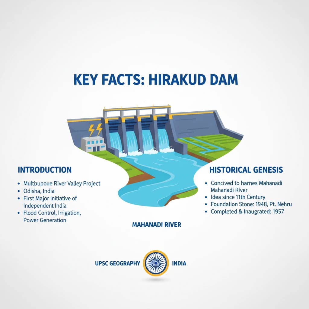
The Hirakud Dam is a monumental multipurpose river valley project located in Odisha, India. It stands as one of the first major developmental initiatives undertaken by independent India.
Conceived to harness the potential of the Mahanadi River, it plays a crucial role in flood control, irrigation, and power generation for the region.
Historical Genesis and Conception
The idea for the Hirakud Dam was first put forth by visionary engineer Sir M. Visvesvaraya in 1937. This proposal came in response to the devastating and recurrent floods experienced in the Mahanadi River basin.
Key Visionary: Er. M. Visvesvaraya
Year of Conception: 1937
Primary Driver: Mitigation of Mahanadi River floods
Construction and Inauguration
Construction of the Hirakud Dam commenced shortly after India's independence, primarily between 1952-1953. It symbolized the nation's commitment to large-scale infrastructure development.
The dam was officially inaugurated in 1957 by the then Prime Minister, Jawaharlal Nehru, marking a significant milestone in India's journey towards self-sufficiency.
Key Architectural and Geographical Features
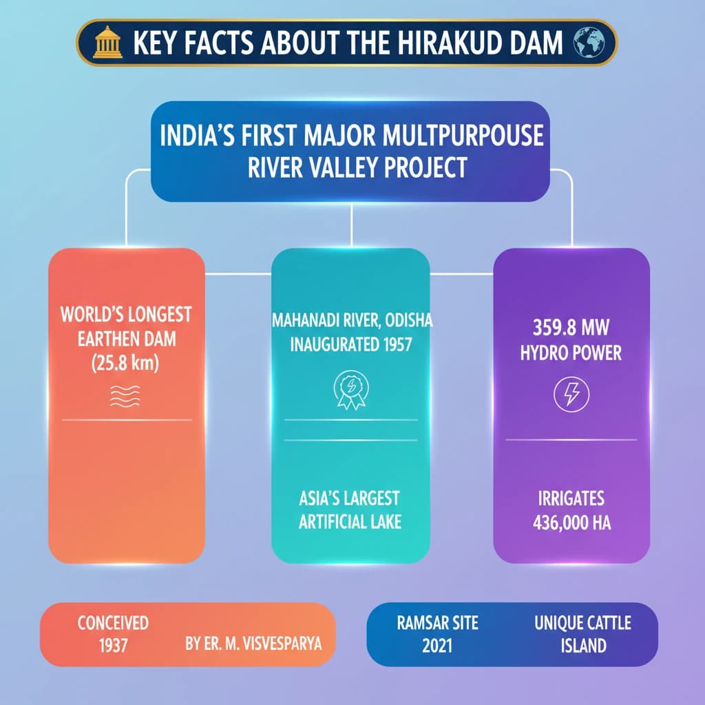
The Hirakud Dam holds the distinction of being the longest major earthen dam globally. Its impressive length spans 25.8 km across the Mahanadi River.
Global Record: Longest major earthen dam
Length: 25.8 km
River: Mahanadi River
The dam impounds water to form the vast Hirakud Reservoir, also famously known as Hirakud Lake. This artificial lake is recognized as one of the largest in Asia.
Multipurpose Benefits and Impact
The Hirakud Dam serves multiple critical functions, contributing significantly to the economic and social development of Odisha and surrounding areas.
- Hydroelectric Power Generation: It has an installed capacity of 359.8 MW, providing essential energy to the region.
- Irrigation: The reservoir facilitates irrigation for a vast agricultural area, covering approximately 436,000 hectares of land.
Unique Ecological Aspect: Cattle Island
Within the expansive Hirakud Reservoir lies a distinctive feature known as Cattle Island. This island is situated at one of the extreme points of the reservoir.
Cattle Island is notable for being inhabited by a substantial herd of wild cattle, making it a unique ecological spot within the dam's periphery.
Environmental Recognition: Ramsar Site Status
The ecological significance of the Hirakud Reservoir received international recognition in 2021. It was officially declared a Ramsar site.
Ramsar Site Designation: Hirakud Reservoir
Year: 2021
Significance: Recognition as a Wetland of International Importance
💡 Key Takeaways
- •Hirakud Dam is India's first major multipurpose river valley project post-independence, conceived by Er. M. Visvesvaraya in 1937.
- •It is the longest major earthen dam globally (25.8 km) across the Mahanadi River in Odisha.
- •Inaugurated by PM Jawaharlal Nehru in 1957, it has an installed capacity of 359.8 MW for hydroelectric power.
- •The Hirakud Reservoir (Hirakud Lake) is one of Asia's largest artificial lakes and was declared a Ramsar site in 2021.
- •Provides irrigation to 436,000 hectares and features unique Cattle Island within its reservoir.
🧠 Memory Techniques

98% Verified Content
📚 Reference Sources
•Official websites of Ministry of Water Resources, Government of India
•Ramsar Sites Information Service