Loading page, please wait…
What is Deep Sea Bed Mining? - UPSC Geography
What is What is Deep Sea Bed Mining? in UPSC Geography?
What is Deep Sea Bed Mining? is a key topic under Geography for UPSC Civil Services Examination. Key points include: Deep-sea mining extracts critical minerals (e.g., copper, cobalt, rare earths) from ocean depths of 200-6500m.. Technological advancements, especially in underwater robotics, have made deep-sea mining more viable.. India's NIO is actively developing deep-sea mining systems, aiming for 6,000m depth capability.. Understanding this topic is essential for both UPSC Prelims and Mains preparation.
Why is What is Deep Sea Bed Mining? important for UPSC exam?
What is Deep Sea Bed Mining? is a Medium-level topic in UPSC Geography. It is tested in both Prelims (factual MCQs) and Mains (analytical answer writing). Previous year UPSC questions have frequently covered aspects of What is Deep Sea Bed Mining?, making it essential for comprehensive IAS preparation.
How to prepare What is Deep Sea Bed Mining? for UPSC?
To prepare What is Deep Sea Bed Mining? for UPSC: (1) Study the comprehensive notes covering all key concepts on Vaidra. (2) Practice previous year questions on this topic. (3) Connect it with current affairs using daily updates. (4) Revise using key takeaways and mind maps available for Geography. (5) Write practice answers linking What is Deep Sea Bed Mining? to related GS Paper topics.
Key takeaways of What is Deep Sea Bed Mining? for UPSC
- Deep-sea mining extracts critical minerals (e.g., copper, cobalt, rare earths) from ocean depths of 200-6500m.
- Technological advancements, especially in underwater robotics, have made deep-sea mining more viable.
- India's NIO is actively developing deep-sea mining systems, aiming for 6,000m depth capability.
- Baselines are fundamental reference lines for defining a nation's maritime zones (territorial sea, EEZ) under UNCLOS.
- Deep-sea mining presents a balance between strategic resource security and significant environmental and regulatory challenges.
What is Deep Sea Bed Mining?
Medium⏱️ 8 min read
geography
📖 Introduction
Understanding Deep Sea Bed Mining
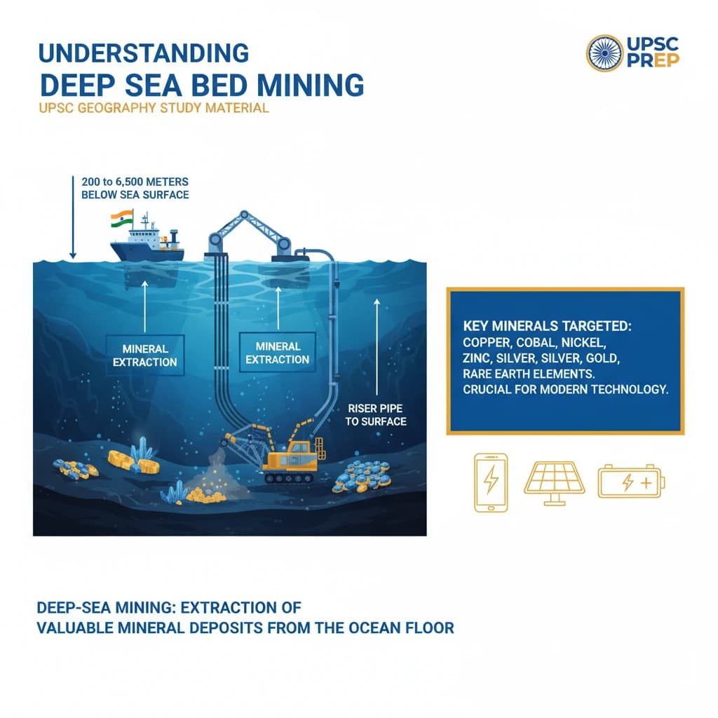
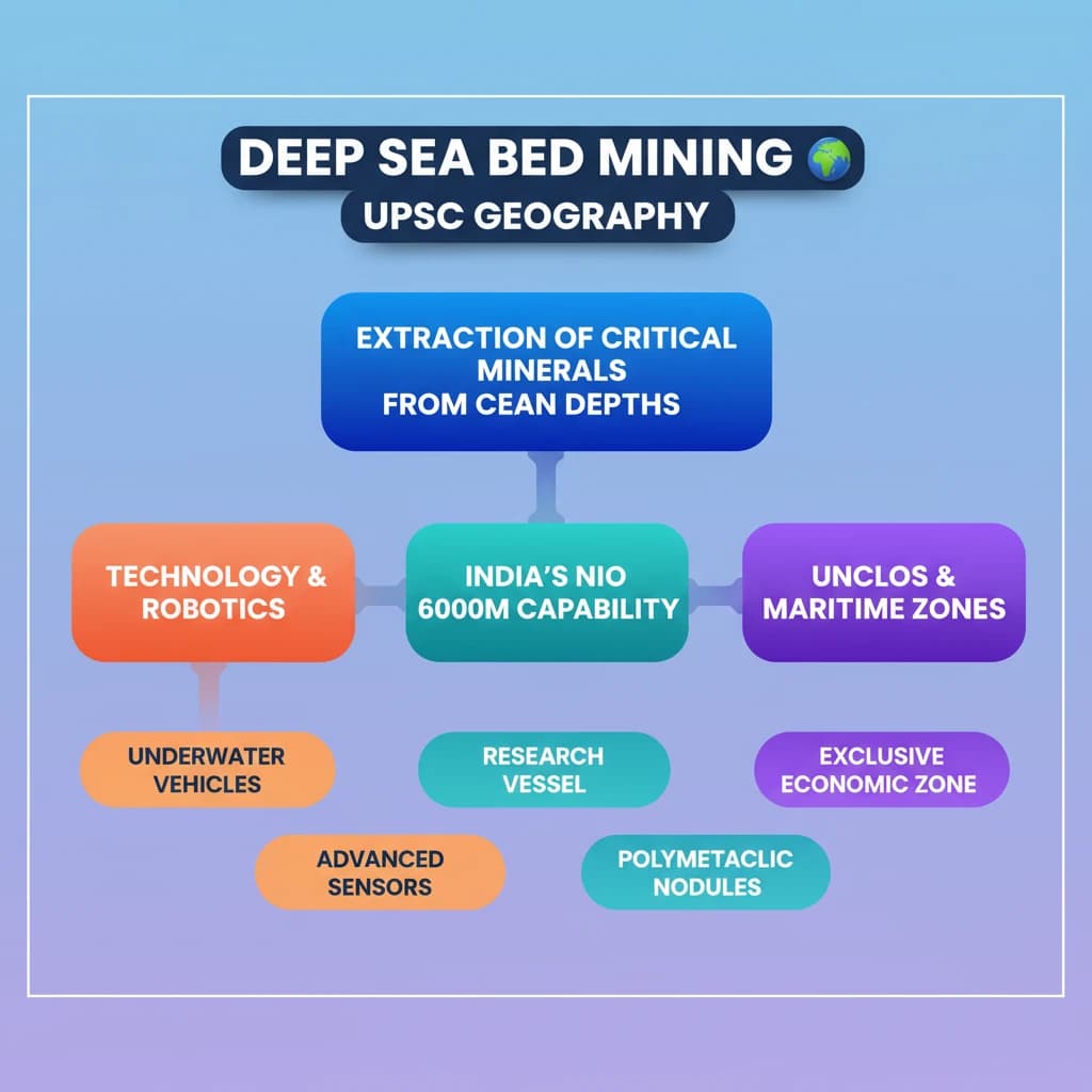
Deep-sea mining involves the extraction of valuable mineral deposits from the ocean floor. These operations occur at significant depths, typically ranging from 200 to 6,500 meters below the sea surface.
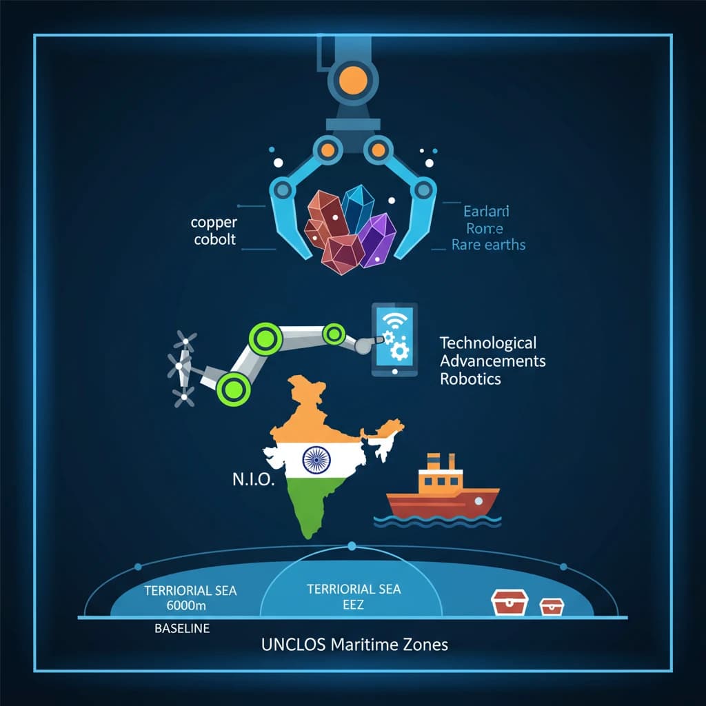
Key minerals targeted include copper, cobalt, nickel, zinc, silver, gold, and various rare earth elements. These are crucial for modern technologies and green energy solutions.
Technological Advancements and Feasibility
Historically, establishing deep-sea mines was considered far more expensive than traditional land-based mining. This economic barrier limited early exploration and development.
However, significant innovations in underwater robotics, largely stemming from the petroleum industry, have dramatically improved the prospects and feasibility of deep-sea mining operations.
India's Role: National Institute of Oceanography (NIO)
India, through the National Institute of Oceanography (NIO), is actively involved in deep-sea research and technology development. NIO has successfully tested deep-sea mining systems.
NIO has conducted tests for deep-sea mining systems up to a depth of 512 meters. The institute is currently working on developing more advanced systems capable of operating at depths of up to 6,000 meters.
Defining Maritime Zones: The Baseline Concept
A baseline is a crucial reference line used in international maritime law. It serves as the starting point for measuring the outer boundaries of a state’s various maritime zones.
These zones include the territorial sea, contiguous zone, exclusive economic zone (EEZ), and the continental shelf, each granting different rights and jurisdictions to the coastal state.
Establishing Baselines: Standard and Exceptions
Typically, the baseline mirrors the low-water mark along the natural coastline of the coastal state. This is the most common method for determining maritime boundaries.
However, in specific geographical circumstances, straight baselines may be established. These are drawn across features like deeply indented coastlines, groups of islands close to the shore, or highly unstable coastlines.
Understanding baselines and maritime zones is fundamental for questions on UNCLOS (United Nations Convention on the Law of the Sea) in GS Paper II (International Relations) and GS Paper I (Geography).
💡 Key Takeaways
- •Deep-sea mining extracts critical minerals (e.g., copper, cobalt, rare earths) from ocean depths of 200-6500m.
- •Technological advancements, especially in underwater robotics, have made deep-sea mining more viable.
- •India's NIO is actively developing deep-sea mining systems, aiming for 6,000m depth capability.
- •Baselines are fundamental reference lines for defining a nation's maritime zones (territorial sea, EEZ) under UNCLOS.
- •Deep-sea mining presents a balance between strategic resource security and significant environmental and regulatory challenges.
🧠 Memory Techniques
95% Verified Content
📚 Reference Sources
•United Nations Convention on the Law of the Sea (UNCLOS) principles
•International Seabed Authority (ISA) information
•General knowledge of oceanography and resource extraction