Loading page, please wait…
What is the Pacific Ring of Fire? - UPSC Geography
What is What is the Pacific Ring of Fire? in UPSC Geography?
What is the Pacific Ring of Fire? is a key topic under Geography for UPSC Civil Services Examination. Key points include: The Pacific Ring of Fire is a 40,000 km belt around the Pacific Ocean, known for intense seismic and volcanic activity.. It hosts ~75% of world's volcanoes and ~90% of earthquakes.. Activity is caused by subduction at convergent plate boundaries, where plates like the Pacific, Nazca, and Philippine Sea plates interact.. Understanding this topic is essential for both UPSC Prelims and Mains preparation.
Why is What is the Pacific Ring of Fire? important for UPSC exam?
What is the Pacific Ring of Fire? is a Medium-level topic in UPSC Geography. It is tested in both Prelims (factual MCQs) and Mains (analytical answer writing). Previous year UPSC questions have frequently covered aspects of What is the Pacific Ring of Fire?, making it essential for comprehensive IAS preparation.
How to prepare What is the Pacific Ring of Fire? for UPSC?
To prepare What is the Pacific Ring of Fire? for UPSC: (1) Study the comprehensive notes covering all key concepts on Vaidra. (2) Practice previous year questions on this topic. (3) Connect it with current affairs using daily updates. (4) Revise using key takeaways and mind maps available for Geography. (5) Write practice answers linking What is the Pacific Ring of Fire? to related GS Paper topics.
Key takeaways of What is the Pacific Ring of Fire? for UPSC
- The Pacific Ring of Fire is a 40,000 km belt around the Pacific Ocean, known for intense seismic and volcanic activity.
- It hosts ~75% of world's volcanoes and ~90% of earthquakes.
- Activity is caused by subduction at convergent plate boundaries, where plates like the Pacific, Nazca, and Philippine Sea plates interact.
- Subduction leads to melting rocks (magma) causing volcanoes, and plate friction causing earthquakes.
- Countries like Japan, Indonesia, Chile, and the USA are located within this zone.
- Recent research indicates the Pacific Plate is cooling, potentially altering future tectonic dynamics.
What is the Pacific Ring of Fire?
Medium⏱️ 8 min read
geography
📖 Introduction
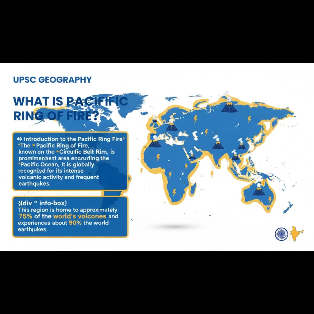
Introduction to the Pacific Ring of Fire
The Pacific Ring of Fire, also known as the Circum-Pacific Belt or Pacific Rim, is a prominent area encircling the Pacific Ocean. It is globally recognized for its intense volcanic activity and frequent earthquakes.
This region is home to approximately 75% of the world's volcanoes and experiences about 90% of the world's earthquakes, making it the most seismically and volcanically active zone on Earth.
Geographical Extent and Key Boundaries
The Ring of Fire stretches for an impressive distance of approximately 40,000 kilometres. It meticulously traces the boundaries between several major tectonic plates, which are the primary drivers of its geological dynamism.
- Key plates involved include the Pacific Plate, Juan de Fuca Plate, Cocos Plate, Indian-Australian Plate, Nazca Plate, American Plate, and Philippine Plate.
The chain's path begins along the western coast of South America and extends northward along the western coast of North America. It then crosses over the Aleutian Islands in Alaska.
From there, it runs southward along the eastern coast of Asia, past New Zealand, and finally extends into the northern coast of Antarctica, forming a near-continuous arc.
Countries within the Ring of Fire
Numerous countries and territories are situated within this active zone, making them particularly vulnerable to geological hazards. These nations often have advanced disaster preparedness systems due to this constant threat.
- Asian Countries: Indonesia, Philippines, Japan, Russia.
- Oceania: New Zealand, Papua New Guinea, Solomon Islands.
- North & Central America: United States, Canada, Mexico, Guatemala.
- South America: Chile, Peru.
- Antarctica is also part of this extensive geological feature.
Causes of Volcanic and Seismic Activity
The intense geological activity in the Ring of Fire is fundamentally driven by plate tectonics, specifically the process of subduction. This occurs at convergent plate boundaries where tectonic plates move towards each other.
In a subduction zone, one tectonic plate is forced beneath another plate and sinks into the Earth's mantle. This is a very slow process, with movements typically occurring at just one or two inches per year.
As the subducting plate descends, the immense pressure and heat cause the rocks to melt, forming magma. This molten rock is less dense than the surrounding material, causing it to rise towards the Earth's surface.
When this magma reaches the surface, it erupts, leading to volcanic activity. The friction and stress accumulated during plate movement also cause sudden releases of energy, resulting in frequent and powerful earthquakes.
Recent Scientific Insights and Research
Recent scientific research has focused on the dynamics of the Pacific Plate, which is a major driver of tectonic activity within the Ring of Fire. Studies indicate that this massive plate is currently undergoing a process of cooling off.
This cooling process is significant because it has the potential to alter the complex dynamics of the plate boundaries. Such changes could profoundly affect subduction zones and the ongoing processes of mountain-building in the region.
Scientists have specifically observed that the youngest parts of the Pacific Plate (approximately 2 million years old) are cooling and contracting at a notably faster rate compared to the older sections of the plate (around 100 million years old).
Understanding the Pacific Ring of Fire is crucial for UPSC aspirants, especially for Geography (GS Paper I) and Disaster Management (GS Paper III). Questions often relate to its formation, geographical extent, associated hazards, and the impact on human settlements. Be prepared to discuss plate tectonics and subduction in detail.

💡 Key Takeaways
- •The Pacific Ring of Fire is a 40,000 km belt around the Pacific Ocean, known for intense seismic and volcanic activity.
- •It hosts ~75% of world's volcanoes and ~90% of earthquakes.
- •Activity is caused by subduction at convergent plate boundaries, where plates like the Pacific, Nazca, and Philippine Sea plates interact.
- •Subduction leads to melting rocks (magma) causing volcanoes, and plate friction causing earthquakes.
- •Countries like Japan, Indonesia, Chile, and the USA are located within this zone.
- •Recent research indicates the Pacific Plate is cooling, potentially altering future tectonic dynamics.
🧠 Memory Techniques

98% Verified Content
📚 Reference Sources
•USGS (United States Geological Survey)
•National Geographic