Loading page, please wait…
Sahel Region: Geography, Significance, and Impact on African Hydroclimate - UPSC Geography
What is Sahel Region: Geography, Significance, and Impact on African Hydroclimate in UPSC Geography?
Sahel Region: Geography, Significance, and Impact on African Hydroclimate is a key topic under Geography for UPSC Civil Services Examination. Key points include: The Sahel is a semiarid transition zone between the Sahara Desert and humid savannas in West and North-Central Africa.. African Easterly Waves (AEWs) are crucial for Sahelian rainfall and are precursors to Atlantic hurricanes.. Ten UN-defined countries form the Sahel, with the Niger River as a major water source.. Understanding this topic is essential for both UPSC Prelims and Mains preparation.
Why is Sahel Region: Geography, Significance, and Impact on African Hydroclimate important for UPSC exam?
Sahel Region: Geography, Significance, and Impact on African Hydroclimate is a Medium-level topic in UPSC Geography. It is tested in both Prelims (factual MCQs) and Mains (analytical answer writing). Previous year UPSC questions have frequently covered aspects of Sahel Region: Geography, Significance, and Impact on African Hydroclimate, making it essential for comprehensive IAS preparation.
How to prepare Sahel Region: Geography, Significance, and Impact on African Hydroclimate for UPSC?
To prepare Sahel Region: Geography, Significance, and Impact on African Hydroclimate for UPSC: (1) Study the comprehensive notes covering all key concepts on Vaidra. (2) Practice previous year questions on this topic. (3) Connect it with current affairs using daily updates. (4) Revise using key takeaways and mind maps available for Geography. (5) Write practice answers linking Sahel Region: Geography, Significance, and Impact on African Hydroclimate to related GS Paper topics.
Key takeaways of Sahel Region: Geography, Significance, and Impact on African Hydroclimate for UPSC
- The Sahel is a semiarid transition zone between the Sahara Desert and humid savannas in West and North-Central Africa.
- African Easterly Waves (AEWs) are crucial for Sahelian rainfall and are precursors to Atlantic hurricanes.
- Ten UN-defined countries form the Sahel, with the Niger River as a major water source.
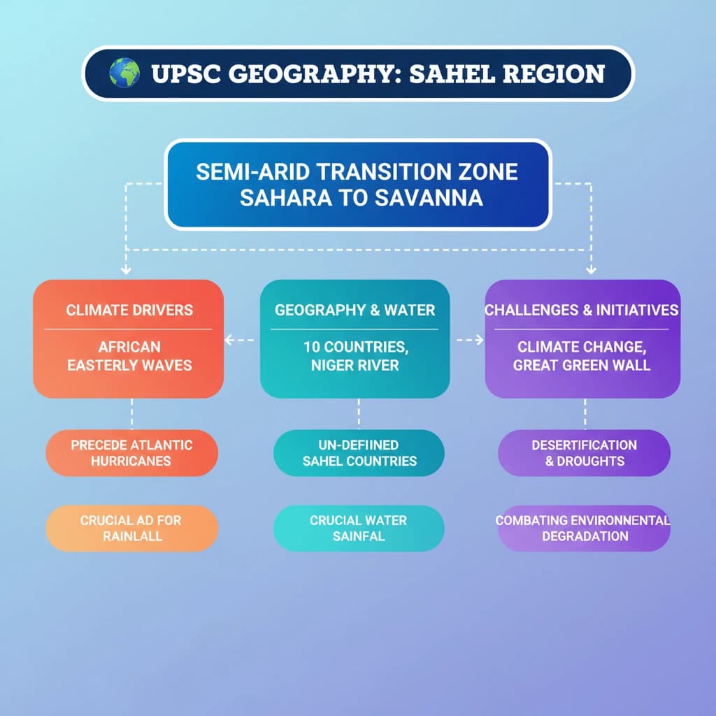
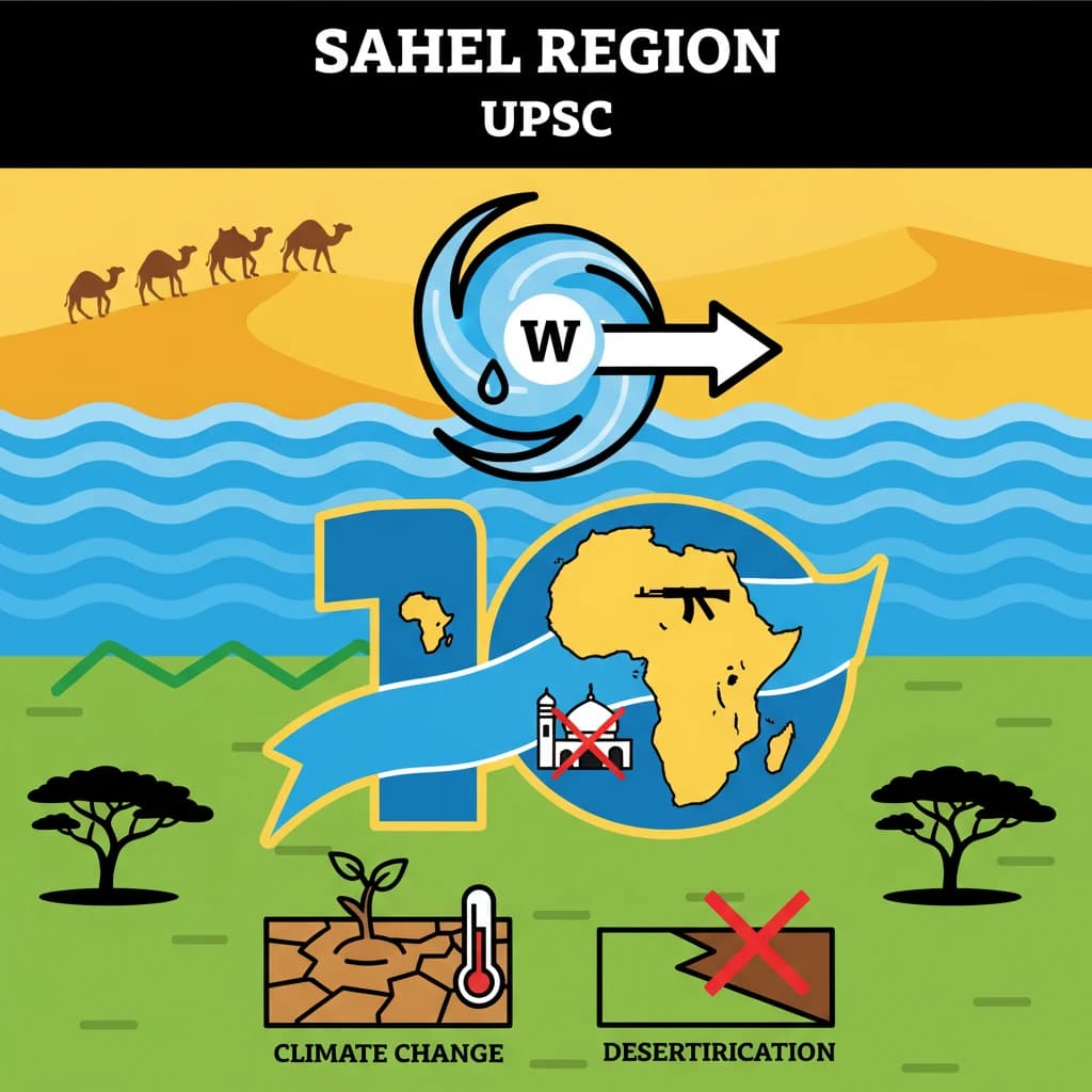
- The region faces severe challenges from climate change (desertification, droughts) and insecurity (extremist groups).
- Initiatives like the Great Green Wall are vital for combating environmental degradation and promoting sustainable development.
Sahel Region: Geography, Significance, and Impact on African Hydroclimate
Medium⏱️ 10 min read
geography
📖 Introduction
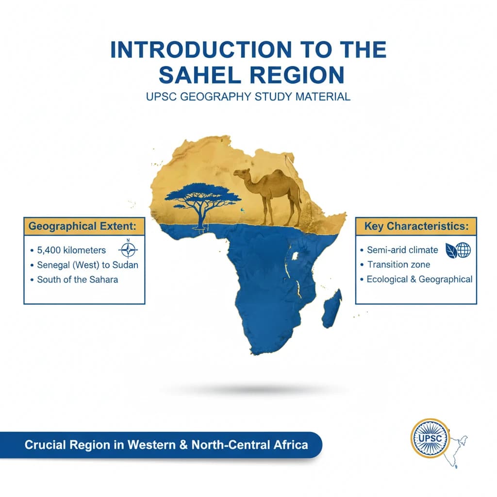
Introduction to the Sahel Region
The Sahel is a crucial semiarid region located in western and north-central Africa. It serves as a vital ecological and geographical transition zone.
Geographical Extent: The Sahel stretches approximately 5,400 kilometers from Senegal in the west to Sudan in the east, encompassing a vast area south of the Sahara Desert.
Geographical Characteristics and Transition Zone
This region acts as a natural buffer, forming a transition between the arid Sahara Desert to its north and the more fertile, humid savannas of tropical Africa to its south.
Its unique position results in a distinct climate and ecosystem, characterized by significant seasonal variations in rainfall.
Ecological Profile of the Sahel
The Sahel features a characteristic savanna terrain. This landscape is typically defined by low-growing grass, interspersed with thorny shrubs and sparse vegetation adapted to dry conditions.
The vegetation density gradually increases as one moves southward towards the savannas, reflecting the increasing rainfall.
The Role of African Easterly Waves (AEWs)
African Easterly Waves (AEWs) play a significant role in the Sahel's climate. These atmospheric disturbances bring much-needed rainstorms to the otherwise drought-prone areas of northern Africa.
Beyond local rainfall, AEWs are also responsible for carrying vast amounts of Saharan dust across the Atlantic Ocean. Furthermore, they act as important precursors for Atlantic hurricanes, influencing global weather patterns.
Understanding AEWs is crucial for UPSC, especially their influence on regional hydroclimate and how their behavior might change under global warming. This connects to Geography (Physical) and Environment sections.
Key Countries of the Sahel
The United Nations (UN) officially recognizes ten countries as part of the Sahel region. These nations face common environmental and socio-economic challenges.
- Burkina Faso
- Cameroon
- The Gambia
- Guinea
- Mali
- Mauritania
- Niger
- Nigeria
- Senegal
- Chad
Major Water Sources
A critical lifeline for the Sahel is the Niger River. It is the longest and largest river in western Africa, providing essential water resources for agriculture, fishing, and human consumption across the region.
💡 Key Takeaways
- •The Sahel is a semiarid transition zone between the Sahara Desert and humid savannas in West and North-Central Africa.
- •African Easterly Waves (AEWs) are crucial for Sahelian rainfall and are precursors to Atlantic hurricanes.
- •Ten UN-defined countries form the Sahel, with the Niger River as a major water source.
- •The region faces severe challenges from climate change (desertification, droughts) and insecurity (extremist groups).
- •Initiatives like the Great Green Wall are vital for combating environmental degradation and promoting sustainable development.
🧠 Memory Techniques
98% Verified Content
📚 Reference Sources
•United Nations Environment Programme (UNEP) reports on the Sahel
•UN-OCHA (Office for the Coordination of Humanitarian Affairs) reports on the Sahel
•National Geographic articles on the Sahel and Great Green Wall
•Encyclopaedia Britannica - Sahel