Overview
On Thursday, 2 April 2026, a Molucca Sea undersea earthquake of 7.4 magnitude struck northern Indonesia. The tremor caused building collapses, at least one death, and generated a modest tsunami that prompted a brief warning.
Key Developments
- Strong shaking (10‑20 seconds) felt in Bitung (North Sulawesi) and Ternate (North Maluku).
- Waves up to 75 cm (30 inches) above normal tide recorded half an hour after the quake.
- Indonesia’s meteorological agency lifted the tsunami warning within hours.
- One fatality – a 70‑year‑old woman in Manado – and several injuries (three hospitalised in Ternate).
- Nearly 50 aftershocks reported in surrounding districts.
Important Facts
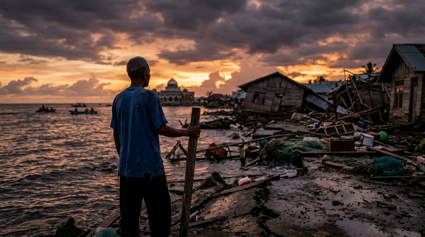
Damage assessments revealed light to severe destruction in Ternate, including a church and two houses. In Bitung, surveys are ongoing. Video footage released by the Search and Rescue Agency showed flattened houses and people evacuating to streets.
The Disaster Management Agency confirmed the intensity of shaking and coordinated rescue operations across the affected provinces.
Exam Relevance
Understanding Indonesia’s seismic risk is vital for GS 4 (Disaster Management) as the archipelago sits on the convergent boundary of the Indo‑Australian and Eurasian plates. The episode illustrates:
- How aftershocks can prolong vulnerability and complicate rescue efforts.
- The role of specialised agencies (meteorological agency, Disaster Management Agency, Search and Rescue Agency) in early warning, assessment, and relief – a model for India’s own disaster‑response architecture.
- Implications for coastal planning, building codes, and community awareness programmes, all of which feature in the GS 4 syllabus.
Way Forward
To mitigate future losses, authorities should:
- Strengthen real‑time seismic monitoring and integrate data with local warning systems.
- Enforce stricter construction norms in high‑risk coastal zones.
- Conduct regular community drills and disseminate clear evacuation protocols.
- Enhance inter‑agency coordination among meteorological, disaster management, and search‑and‑rescue bodies.
These steps align with the broader goal of building resilient societies in seismically active regions, a recurring theme in UPSC examinations.